Professional
weather services
for business

Weathernews for business

Comprehensive weather data and industry-specific content to support your business decision-making.

NETIS (Registration Number: CG-250002-A)

Weathernews for business

Business Weather Data

Customized weather intelligence for professional decision-making

Mobile and Desktop Access

Check forecasts from anywhere—on your desktop at the office or mobile device on-site.

Multi-Location Management

Register multiple facilities, stores, or work sites to track weather and disaster alerts for each location.

Weather intelligence customized for your business needs

Add weather content that enhances your business to the weather app "Weathernews". Anticipate weather impacts and make more informed decisions.

Access Anytime, Anywhere

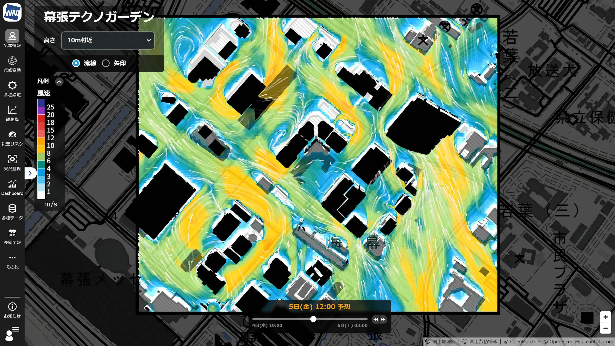
In the office: check weather and disaster prevention information for your business locations nationwide on PC screens. Onsites: receive alerts for sudden, severe weather like guerrilla thunderstorms on your smartphone and check detailed weather forecasts for your current location.

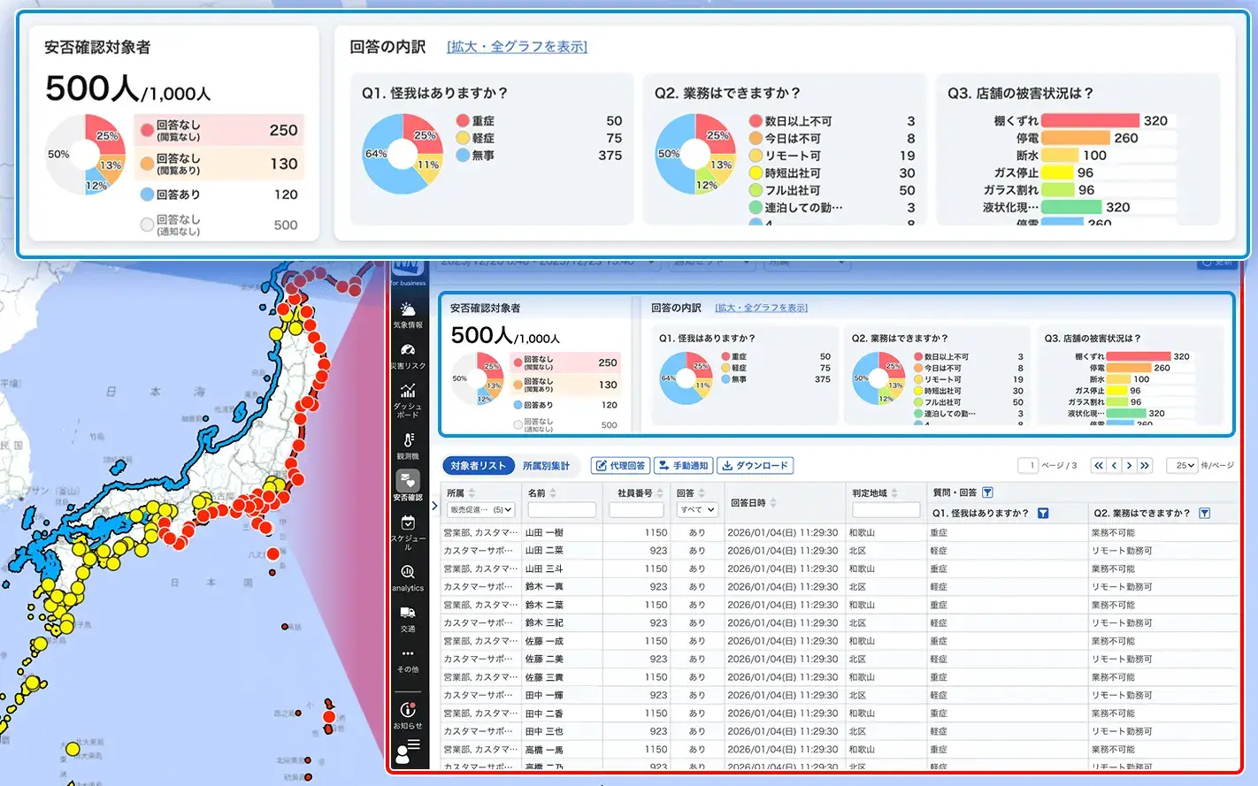
24/7 monitoring of all your locations

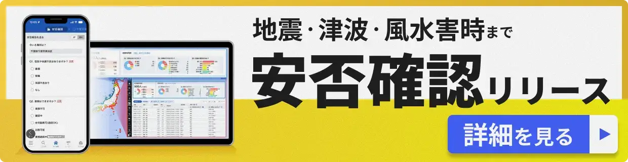
Register all your sites—construction zones, stores, facilities—and view forecasts for every location at a glance. We continuously monitor conditions and send push notifications when heavy rain, strong winds, typhoons, or other severe weather threatens your operations.

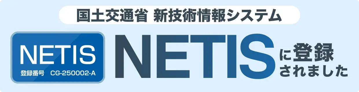
NETIS: Officially recognized by Japan's Ministry of Land, Infrastructure, Transport and Tourism

This system is registered with NETIS (New Technology Information System), Registration Number: CG-250002-A. It meets rigorous standards for reliability and safety in public works projects, giving you a trusted platform for operational efficiency and risk management.

NETIS (Registration Number: CG-250002-A)

Weather Information Content List

Access everything from typhoon and localized heavy rain alerts to specialized weather data not available to the general public—all in one place.

Earthquake & Seismic Intensity Distribution

Check epicenter and seismic intensity information along with estimated seismic intensity distribution maps

Tsunami Information

Display major tsunami warnings, warnings, advisories as quickly as possible

Forecast Max Temperature & Temperature Difference

Visualize temperature changes up to 14 days in advance to aid sales planning.

Option

Weather & Sensory Reports

Check weather, sensory conditions, and snow accumulation on a map

Photo & Video Reports

Display weather and seasonal photos/videos, searchable past reports

Rain Cloud Radar & Lightning

Check rain cloud movement, lightning, and linear precipitation band conditions

Linear Precipitation Band & Heavy Rain Risk

Linear precipitation band announcement status and risk prediction up to 12 hours in advance

Lightning Risk Monitoring

Display lightning conditions, historical data, and periods requiring caution

Option

Rain/Snow Radar

Identify the rain/snow boundary at a glance, check intensity

Snow Accretion Risk Monitoring

Display snow accretion risk up to 3 days ahead on the map and graph

Option

Snow Accumulation Forecast (Heavy Snow Risk)

Check snow accumulation forecast up to 3 days ahead on the map and graph

Risk Distribution (Kikikuru)

Display JMA-issued 'Kikikuru' (landslide, inundation, flood) information

Flooding & Inundation Forecast

Display flooding risk from heavy rain and intense rainfall on map

Heavy Rain Risk Countermeasures

Understand cumulative rainfall forecast up to 3 days ahead, consider heavy rain countermeasures

Weather Warnings & Possibility Information

Display active warnings and advisories, along with warning-level probabilities.

Typhoon Path & Storm Area Forecast

Comprehensive information including typhoon impact time, path probability, and multi-model comparisons.

Wind Forecast (Near Surface)

Understand wind flow up to 3 days ahead with streamline animation

Power Outage Risk Forecast

Understand power outage risk up to 3 days ahead during storms and typhoon approaches

Hail Risk Forecast

Display hail risk on map in 2 levels: 'Caution' and 'Alert'

Option

River Water Level Information

Check river water levels and flood risk on map and graph

Live Camera

View live camera footage from thousands of locations nationwide

AMeDAS

Display nationwide AMeDAS observation data on map & graph

Satellite Images

Check cloud images from around the world for up to 72 hours, in addition to the Japan region.

Weather Charts

View current and weekly forecast weather charts, plus historical weather charts

Heatstroke Risk Level & Alert Information

Forecast heatstroke risk level and WBGT up to 3 days ahead

Thunder Probability

Understand thunderstorm possibility up to 36 hours ahead

Note: Display menus may vary between PC and mobile app versions. Menu items also change seasonally.

Note: Available weather information content varies depending on your service plan.

Feel free to consult with us

We can provide proposals tailored to your challenges, including specific use cases for Weathernews for business. Please feel free to contact us with any pre-implementation questions or consultations.

Why not get a quote first?

We'll explain pricing details and provide specific content based on your site conditions so you can consider with confidence.

Free Quote

Contact us here

We'll explain in detail how to utilize features and the implementation process. Please feel free to consult with us.

Consider Implementation

Optional Add-on Services

In addition to the basic Weathernews for business menu, utilizing the services below enables quick and accurate situational decision-making for your customers.

Cloud Camera

Monitor real-time footage from cloud camera locations to remotely assess site conditions.

View Details

Schedule Function

Pre-set weather risk thresholds on your calendar to determine if conditions are suitable for planned activities.

View Details

Transportation Impact Forecasting

Access transportation impact forecasts: highways up to 10 days ahead, and railways, aviation, and ports up to 72 hours ahead with 3-hour intervals.

View Details

Weather Risk Dashboard

Visualize the proportion of high-impact locations and trends over time for events like heavy rain, storms, and heavy snow, helping you prioritize response strategies.

View Details

Snow Accretion Risk Monitoring for Power Companies

Monitor transmission line snow accretion and falling snow risks using 12-hour cumulative snowfall data, updated hourly with forecasts up to 72 hours ahead.

View Details

River & Dam Management Dashboard

Monitor hourly basin average rainfall forecasts up to 72 hours ahead to support pre-release operations and management decisions.

View Details

Ultra-High Resolution Model

Enhance safety measures and work planning accuracy with high-resolution 5m mesh wind forecasts that account for wind flow around buildings and structures.

View Details