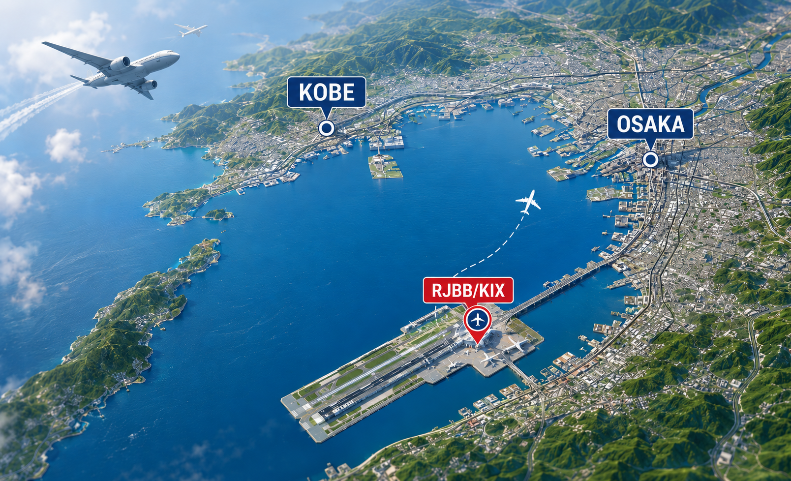
Kansai International Airport (RJBB/KIX) is a major offshore airport located in Osaka Bay and serves as a key international gateway for the Kansai region. Surrounded by complex mountainous terrain, the airport is influenced by multiple local wind regimes that are critical for flight operations. This article summarizes the meteorological characteristics of RJBB, focusing on the relationship between terrain and wind patterns.
Terrain Overview
Kansai International Airport (RJBB/KIX) is located approximately 40km southwest of central Osaka, on an artificial island in Osaka Bay, roughly 4km offshore. Surrounded by mountain ranges and islands on all sides, the airport sits within a uniquely complex meteorological environment.
| Direction | Terrain | Distance from Airport | Representative Peak (Elevation) |
|---|---|---|---|
| North | Rokko Mountains | approx. 40km | Mt. Rokko (3,055ft) |
| Northeast | Ikoma Mountains | approx. 45km | Mt. Ikoma (2,106ft) |
| East | Kongo Mountains | approx. 40km | Mt. Kongo (3,690ft) |
| South | Izumi Range | approx. 15km | Mt. Katsuragi (3,025ft) |
| West | Awaji Island | approx. 30km | Highest point (1,995ft) |
This terrain configuration gives RJBB a hybrid climate — combining both maritime and basin-like meteorological characteristics.
Wind
Three Airflow Corridors into Osaka Bay
The following three topographic gaps act as the primary airflow channels into Osaka Bay, exerting a significantly influence on wind conditions at RJBB:
- Osaka Plain — lowlands along the Yodo River
- Akashi Strait (from the Seto Inland Sea)
- Tomogashima Channel (between Awaji Island and Tomogashima Island)
Airflow through these corridors contributes to lee-side weak wind zones, foehn effects, and atmospheric stagnation over the plain.
Reference Wind Observation Point
Wind values reported in METAR and TAF represent observations taken at the western end of Runway 1 (near the RWY06R touchdown zone).
Three Dominant Wind Directions
Influenced by surrounding terrain, wind at RJBB predominantly falls into three systems, varying by season, time of day, and pressure pattern.
| System | Direction | Inflow Corridor |
|---|---|---|
| ① | Northeast (NE) | Osaka Plain — Yodo River lowlands |
| ② | Southwest (SW) | Tomogashima Channel |
| ③ | Northwest (NW) | Seto Inland Sea → Akashi Strait |
Winds from the southeast (SE) quadrant are rare, as surrounding terrain acts as a natural barrier.
Annual Wind Direction Frequency
| Quadrant | Frequency |
|---|---|
| Northeast (NE) | approx. 25% (most frequent) |
| Southwest (SW) | approx. 20% |
| Northwest (NW) | approx. 20% |
| Southeast (SE) | Infrequent |
Strong Wind Days (Annual Average)
| Threshold | Notes |
|---|---|
| Daily max ≥20 KT | 10+ days per month in winter |
| Daily max ≥30 KT | Concentrated in winter |
| Daily max ≥40 KT | Associated with developing lows or typhoon approach |
Seasonal and Diurnal Variation
Seasonal Variation
- Winter: Strongest winds; daily max ≥20 KT on 10+ days per month
- Summer: Weakest winds; risk of sudden strong winds during typhoon approach
While seasonal variation in wind speed is not dramatic, a clear tendency toward stronger winds in winter and weaker winds in summer is observed.
Diurnal Variation (Sea-Land Breeze)
| Time of Day | Dominant Direction | Wind Speed |
|---|---|---|
| Night – Early morning (around 06:00) | Northeast (land breeze) | Weakest |
| Daytime – Evening (around 16:00) | Southwest (sea breeze) | Strongest |
Diurnal variation is generally well-defined throughout the year.