Current Situation
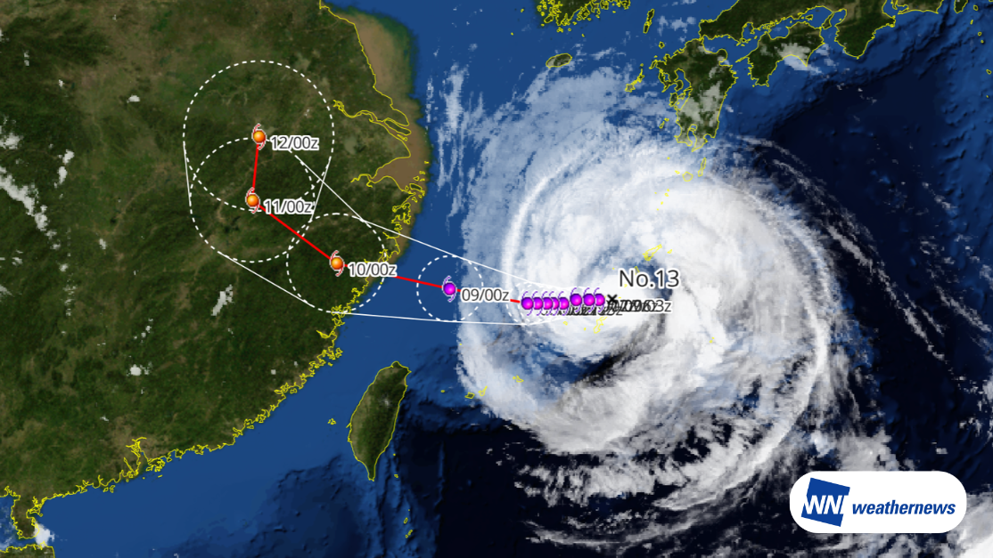
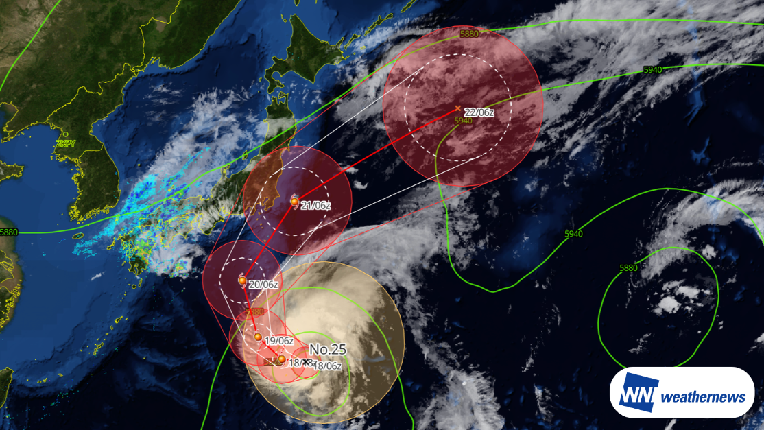
According to information released by the Japan Meteorological Agency (JMA) at 12:45 p.m. JST on August 7, 2026, Typhoon Dolphin (No. 13) — a large and powerful storm — was located near Yoronjima (27.0°N, 128.2°E) as of 12:00 p.m. on August 7, moving west at 14 kt. The central pressure was 940 hPa, with maximum sustained winds of 75 kt near the center and maximum gusts of 105 kt.
Forecast Track
Typhoon Dolphin is expected to pass through the Nansei Islands during the day on August 7 before moving into the East China Sea. Its forward speed will then gradually slow as it approaches the coast of East China. The storm may make landfall along the coast between Zhejiang and northern Fujian provinces sometime between the afternoon of August 9 and the morning of August 10, while still maintaining typhoon or severe typhoon intensity. After landfall, it is expected to track west-northwest while gradually weakening.
Fuzhou Changle International Airport (ZSFZ / FOC) Outlook
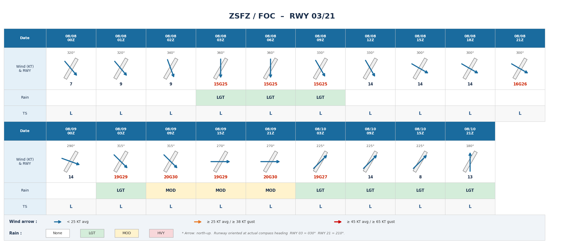
The period of greatest concern is 03 UTC on August 9 through 03 UTC on August 10, when the runway crosswind component could approach 20 kt. Crosswinds during takeoff and landing may affect operations.
Ningbo Lishe International Airport (ZSNB / NGB) Outlook
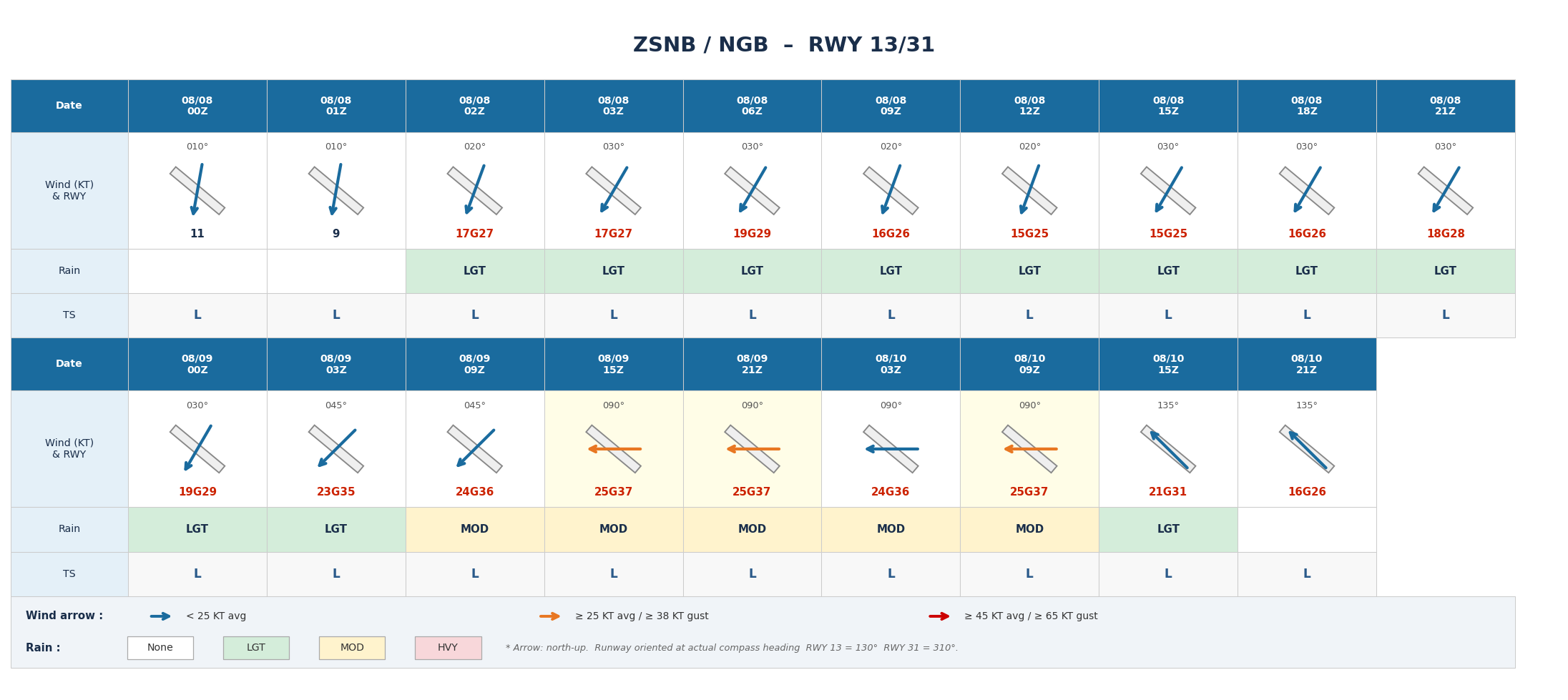
Average wind speeds of 23-25 kt are expected between 03 UTC and 15 UTC on August 9, with the runway crosswind component reaching around 20 kt. Besides the crosswind impact on operations, periods of moderate rainfall are also possible.
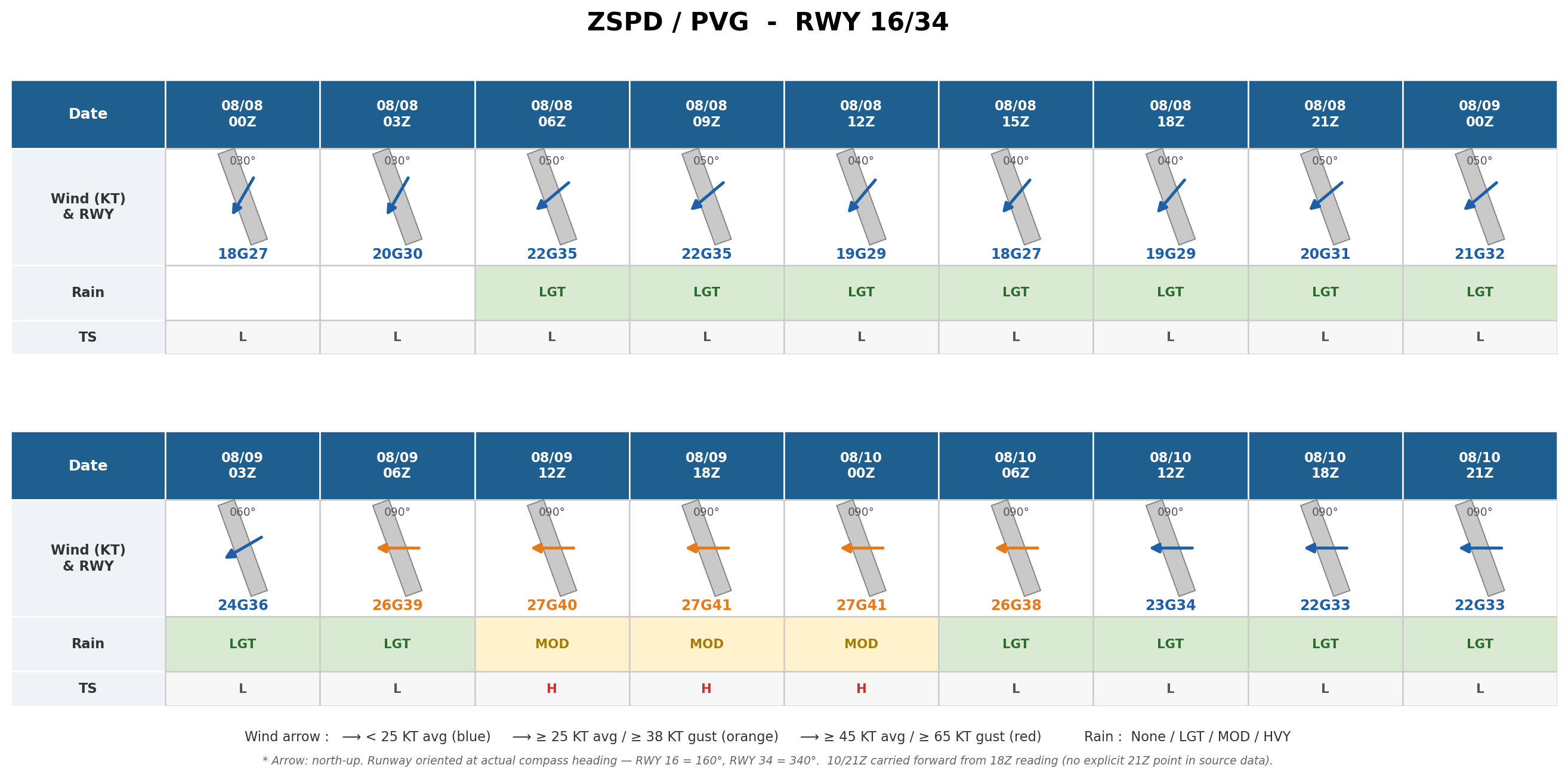
Shanghai Pudong International Airport (ZSPD / PVG) Outlook
Average wind speeds of 15 kt or higher are expected to continue through August 10. Between 06 UTC on August 9 and 12 UTC on August 10 in particular, average winds may reach 25 kt or higher with a runway crosswind component of 20 kt or more, along with periods of moderate rainfall.
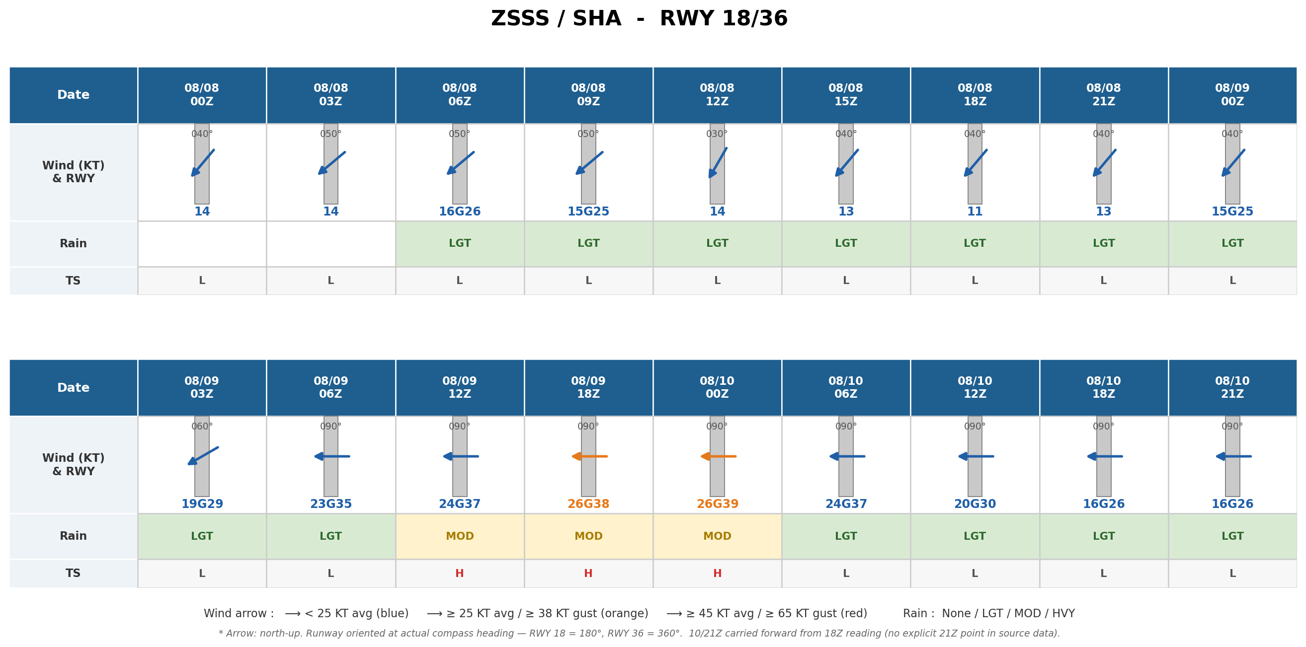
Shanghai Hongqiao International Airport (ZSSS / SHA) Outlook
The runway crosswind component is expected to exceed 20 kt between 06 UTC on August 9 and 12 UTC on August 10. Average wind speeds are also expected to reach 25 kt or higher between 18 UTC on August 9 and 06 UTC on August 10, and crosswinds may affect operations during this period.
Important Notes
Significant uncertainty remains regarding the storm's future development and exact track. Conditions may continue to change, so please keep checking the latest forecasts.
For more timely and detailed information on typhoons and tropical disturbances, please visit SkyAviators, our decision-support tool for aviation operators. We encourage you to use it to keep track of future developments. Learn more about "SkyAviators"
This article is provided for reference purposes only. Specific operational support for individual flights is available exclusively through our paid services for aviation operators. Weathernews Inc. accepts no responsibility for any operational decisions made based on this article, or for any losses or damages resulting therefrom.
![[Tropical Depression] Forecasted to Become Typhoon DUJUAN – Expected to Approach Japan as a "Strong" System](https://gvs.weathernews.jp/wxtech_cms/typhoon25_dujuan_cover_de9913c666.png)