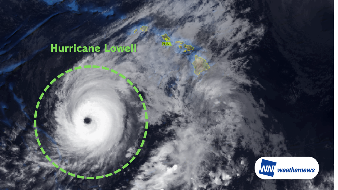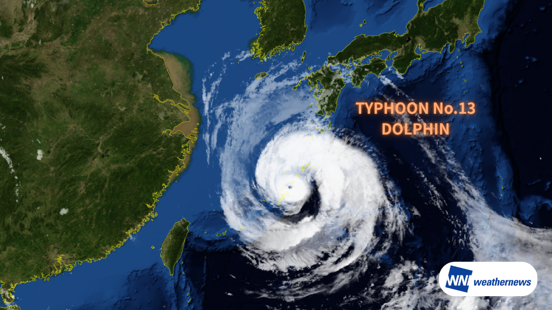
Current Status
According to information released by the Japan Meteorological Agency (JMA) at 09:50 JST on August 7, 2026, large and powerful Typhoon No. 13 (DOLPHIN) was located about 30 km southeast of Okinoerabu Island (27.2°N, 128.9°E) as of 09:00 JST that day, moving west at 14 kt. The central pressure is 950 hPa, with maximum sustained winds near the center of 75 kt and maximum gusts of 105 kt.
Track Outlook
Typhoon No. 13 is expected to continue moving westward, passing near the main island of Okinawa from midday into the evening of August 7. Because of its slow movement and wide storm-force wind radius, Okinawa could see prolonged heavy rain, strong winds, and high waves. At Naha Airport (ROAH/OKA), winds exceeding 50 kt are expected, which could significantly affect aircraft takeoffs, landings, and overall airport operations.
The typhoon is then forecast to continue westward, moving from the East China Sea toward waters north of Taiwan between August 8 and August 9, before making landfall in China around August 10. Taoyuan International Airport (RCTP/TPE) and Taipei Songshan Airport (RCSS/TSA) in northern Taiwan should watch closely for operational impacts from rainfall and shifting wind conditions.
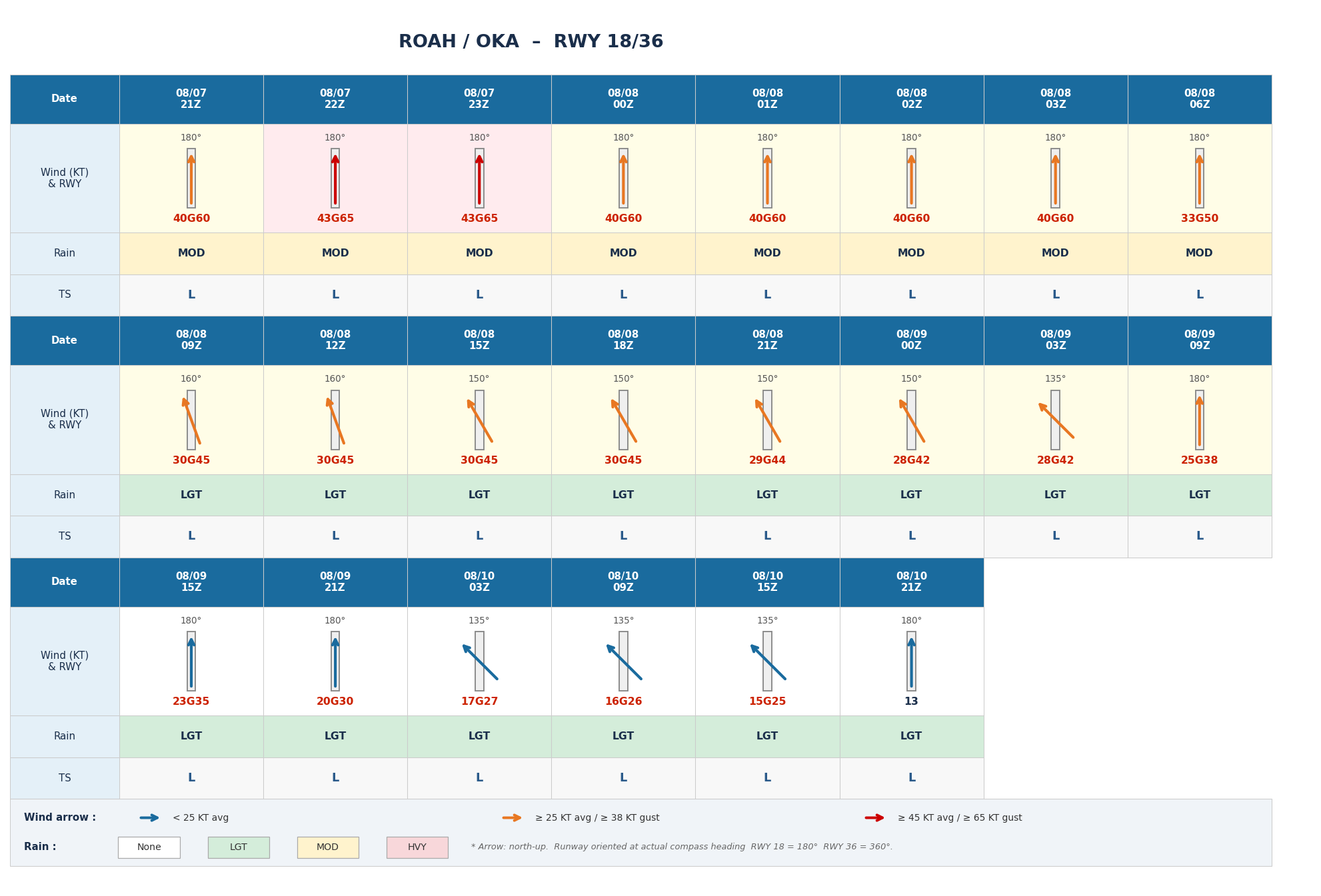
Naha Airport (ROAH/OKA) Forecast
Very strong winds averaging 40–45 kt are expected until 00 UTC on August 8. Winds are then expected to ease below 30 kt from around 21 UTC on August 8, and drop further below 20 kt from 03 UTC on August 10 as the typhoon continues moving west.
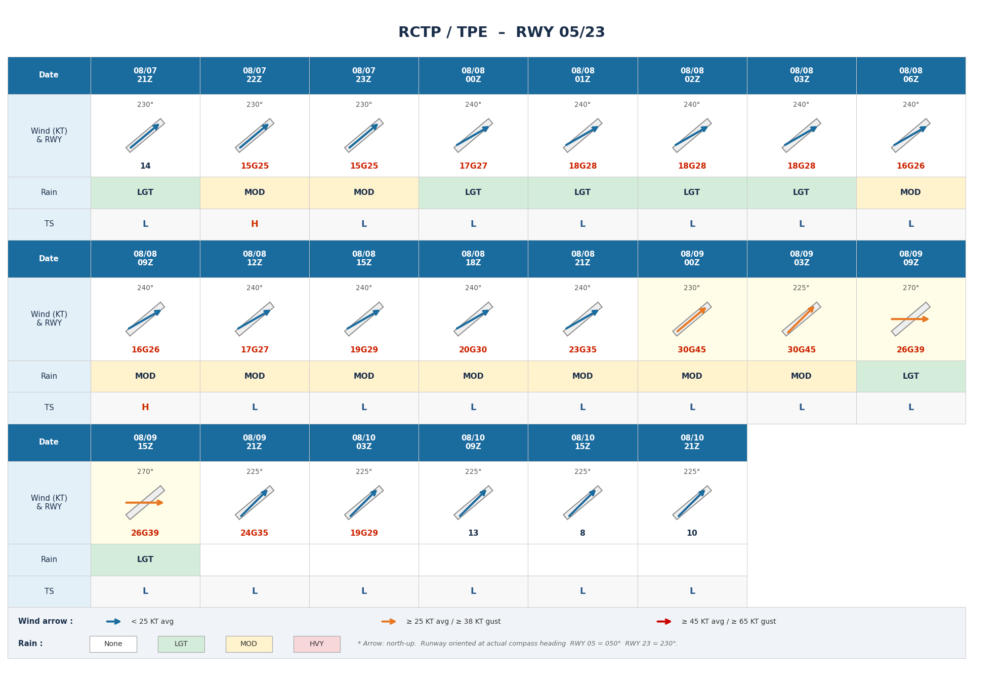
Taoyuan International Airport (RCTP/TPE) Forecast
The period of greatest concern is 00–09 UTC on August 9, with average winds of around 30 kt along with moderate precipitation expected. Winds are expected to ease below 20 kt from 03 UTC on August 10.
Taipei Songshan Airport (RCSS/TSA) Forecast
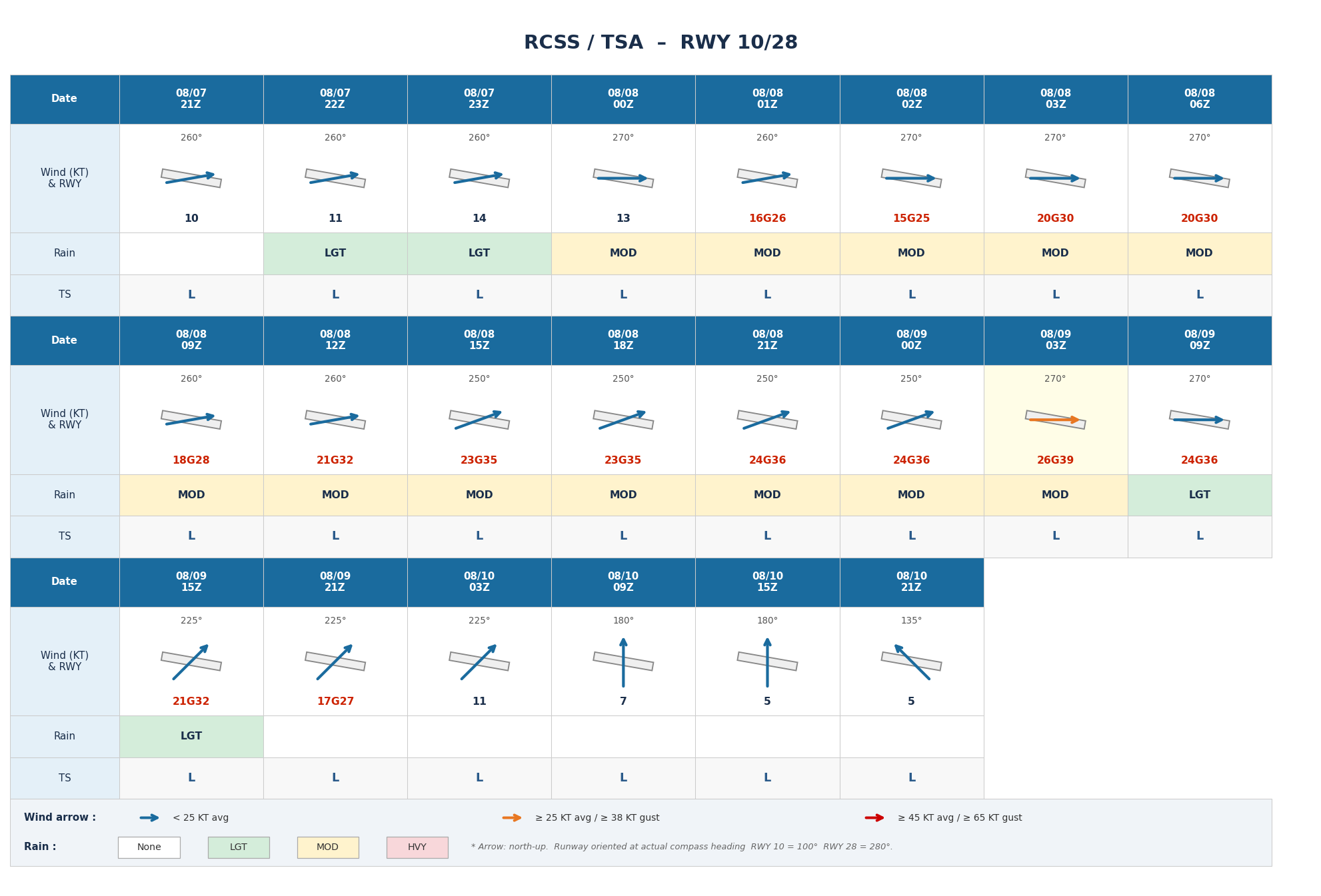
Moderate showers are expected throughout the day on August 8. Average winds are expected to exceed 25 kt between 03–09 UTC on August 9, gradually weakening afterward and dropping below 20 kt from 21 UTC on August 9.
Notes
Significant uncertainty remains regarding the typhoon's future development and detailed track. Conditions may change, so please continue to monitor the latest weather forecasts.
For more timely, detailed typhoon and tropical disturbance information, check SkyAviators, our decision-support tool for aviation operators. Learn more about "SkyAviators"
This article is provided for reference purposes only. Specific operational support information for individual flights is provided solely through our paid services for aviation operators. Weathernews Inc. assumes no responsibility for any operational decisions made based on this article, or for any losses or damages arising from such decisions.
![[Tropical Depression] Forecasted to Become Typhoon DUJUAN – Expected to Approach Japan as a "Strong" System](https://gvs.weathernews.jp/wxtech_cms/typhoon25_dujuan_cover_de9913c666.png)