









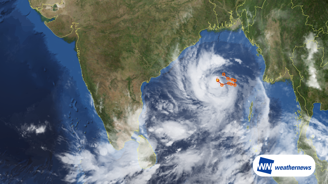
Tropical low "Cyclone Arnab(02B)," located over the central Bay of Bengal, is forecast to track west-northwest to northwest while intensifying further. The system is expected to make landfall along the east coast of India (coastal Andhra Pradesh) during the morning of October 28 local time as a strong system at Very Severe Cyclonic Storm intensity.
Cyclone Arnab(02B): Current Position & Analysis
- Analysis Time: October 26, 2026, at 00:00 UTC (09:00 JST / 05:30 Local Time)
- Center Position: 16.0°N, 89.0°E (Central Bay of Bengal)
- Central Pressure: 998 hPa
- Maximum Sustained Winds: 35 kt
- Maximum Gusts: 50 kt
- Gale Wind Radius (≥35 kt): 40 NM
- Movement: Northwest (316°) at 7 kt
Track & Intensity Outlook
1. Rapid Intensification (October 26 Afternoon – October 27)
The system will gain strength while tracking westward during the day on October 26, and is expected to intensify into a Severe Cyclonic Storm by the morning of October 27. It will continue to strengthen, potentially peaking around the evening of October 27 local time with a central pressure of 966 hPa, maximum sustained winds of 70 kt, and gusts up to 100 kt.
2. Landfall on India's East Coast (Morning of October 28)
Cyclone Arnab(02B) is projected to cross the coast of Andhra Pradesh between Bapatla and Visakhapatnam by the morning of October 28 at Very Severe Cyclonic Storm intensity.
3. Post-Landfall Weakening (Late October 28 – October 29)
After making landfall, the cyclone will turn northward into the interior and progressively weaken due to frictional interaction with land and topography. By October 29 at 00:00 UTC, maximum sustained winds are expected to decrease to 30 kt.
Potential Impacts on Visakhapatnam Airport (VOVZ / VTZ)
- Weather Overview: Rain and wind are forecast to intensify around the airport from the afternoon of October 27 through October 28 as Cyclone Arnab(02B) approaches and makes landfall.
- Forecast Winds: Average sustained winds of 20–30 kt. (Note: Higher gusts may occur temporarily during the closest approach or with convective cloud bands passing over the airfield.)
Looking Ahead
Typhoon track, intensity, and wind speed forecasts at the time of closest approach may change. Please continue to monitor the latest typhoon information, airport forecasts, and operational updates.
For more timely and detailed information on typhoons and tropical disturbances, please visit SkyAviators, the aviation decision-support tool for airline operators. Learn more about "SkyAviators"
Disclaimer
This article is provided for general informational purposes only. Tailored operational flight dispatch and operational support are provided exclusively through Weathernews' dedicated commercial aviation services. Weathernews Inc. accepts no liability whatsoever for operational decisions, losses, or damages arising directly or indirectly from the use of this information.