








Current Status
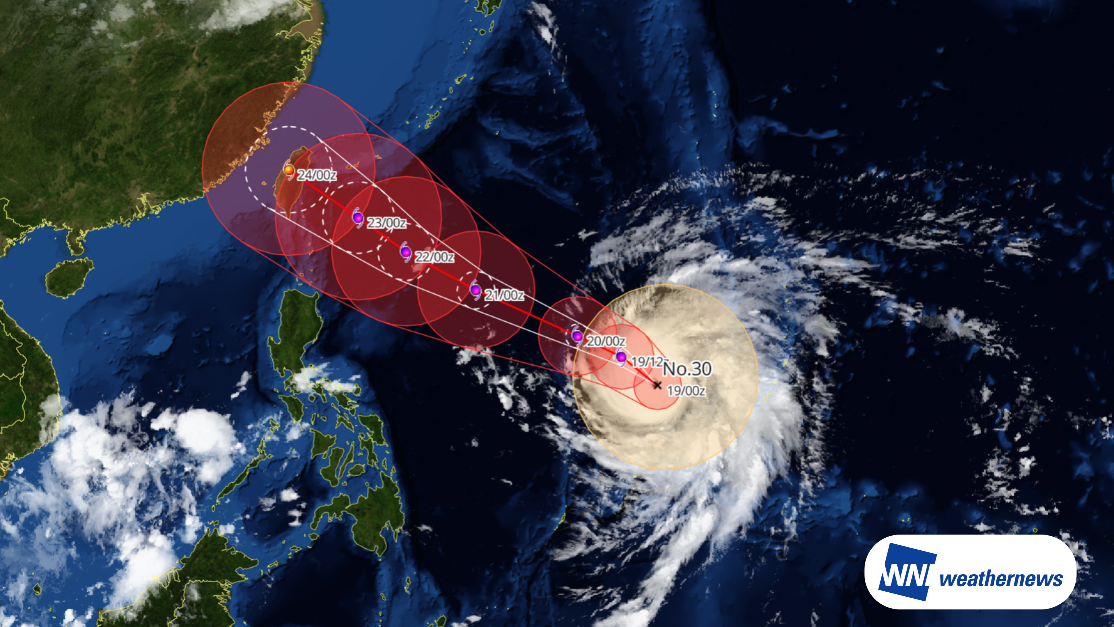
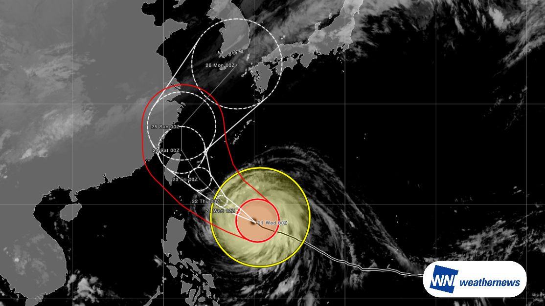
According to information released by the Japan Meteorological Agency (JMA) at 09:45 JST on October 21, 2026, large and violent Typhoon 30 (CHAMPI) was located east of the Philippines (18.1°N, 130.2°E) as of 09:00 JST on October 21, moving west-northwest at 13 knots. The central pressure is 900 hPa, with maximum sustained winds near the center of 115 knots and maximum instantaneous wind gusts of 165 knots.
Track and Intensity Outlook
Forecast models from various meteorological agencies show significant spread, and the extent of impacts will vary depending on the exact track.
The typhoon is expected to continue tracking west-northwest while maintaining intense strength, before gradually turning northwestward. It is forecast to pass near the Sakishima Islands as a very strong typhoon from late afternoon to early evening on October 23. In Okinawa, high probabilities of torrential rain, violent winds, and high waves are anticipated, centered around the Sakishima Islands.
Regarding potential impacts on Taiwan, whether the future track shifts further north or south will be a decisive factor. According to Taiwan's Central Weather Administration (CWA), the probability of tropical storm-force winds occurring in Keelung City within the next 120 hours stands at 72%.
This "storm strike probability" indicates the likelihood of experiencing wind speeds of 17.2 m/s (Beaufort Force 7) or higher at that location during the forecast period. It is calculated based on historical forecast verification for similar typhoon tracks over the past five years; for example, an 80% probability means that gale-force winds were observed in approximately 80 out of 100 analogous historical cases.
Current track projections increasingly suggest the typhoon will recurve from north to northeast. It is expected to move northeast across the East China Sea while weakening, posing a risk of landfall in the Kyushu region.
Looking Ahead
Typhoon track, intensity, and wind speed forecasts at the time of closest approach may change. Please continue to monitor the latest typhoon information, airport forecasts, and operational updates.
For more timely and detailed information on typhoons and tropical disturbances, please visit SkyAviators, the aviation decision-support tool for airline operators. Learn more about "SkyAviators"
Disclaimer
This article is provided for reference purposes only. Specific operational support for individual flights is available exclusively through our paid aviation services. Weathernews Inc. assumes no liability for operational decisions made based on this article or for any losses or damages arising therefrom.