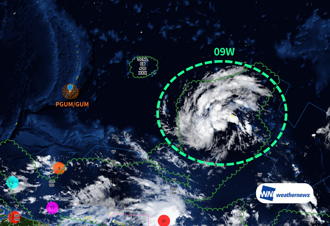
Current Status
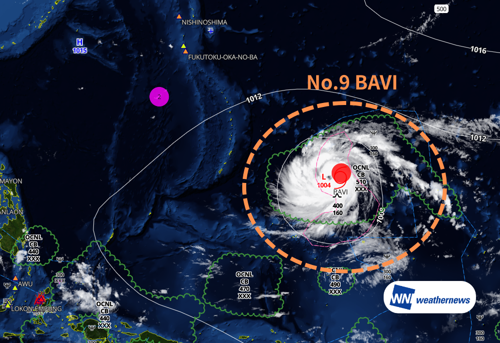
According to information released by the Japan Meteorological Agency (JMA) at 10:10 JST on July 3, 2026, Typhoon No. 9 (BAVI) is currently located near the Marshall Islands (12.8°N, 155.6°E) as of 09:00 JST on July 3, moving westward at 12 knots. Central pressure is 975 hPa, with maximum sustained winds of 65 kt and maximum gusts of 95 kt.
Track Forecast
The typhoon is expected to intensify rapidly while tracking westward, passing near Saipan as a violent typhoon around July 6.
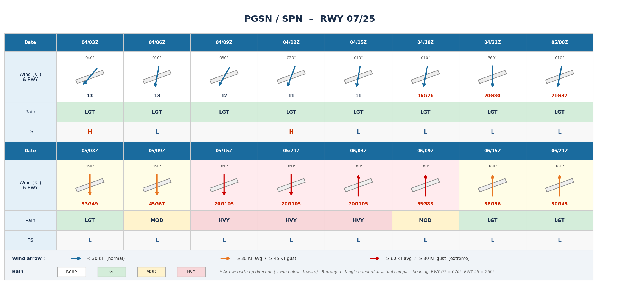
Impact on Saipan International Airport (PGSN / SPN)
At Saipan International Airport (PGSN), the peak impact period is expected from July 5 at 15Z through July 6 at 09Z (all times UTC).
Wind and rain are expected to intensify rapidly during this period. At peak, sustained winds are forecast to exceed 70 kt, with maximum gusts exceeding 100 kt — an extremely dangerous situation. Significant visibility reduction due to heavy rain (HVY) is also anticipated. RWY 07/25 will experience large crosswind components regardless of wind direction (north or south), with strong crosswind conditions expected throughout most of the period from July 5 09Z through July 6 09Z. The typhoon eye is expected to pass near the island between July 5 21Z and July 6 03Z, potentially causing a rapid wind shift from north to south.
After typhoon passage, winds will gradually subside from July 6 09Z onward. By July 6 15Z, sustained winds are expected to be around 35–40 G55 kt, and by July 6 21Z, around 30 G45 kt. However, gusts may still exceed 50 kt immediately following passage, and continued caution is advised. Intermittent light rain (LGT) may persist, though operational impacts are expected to gradually diminish.
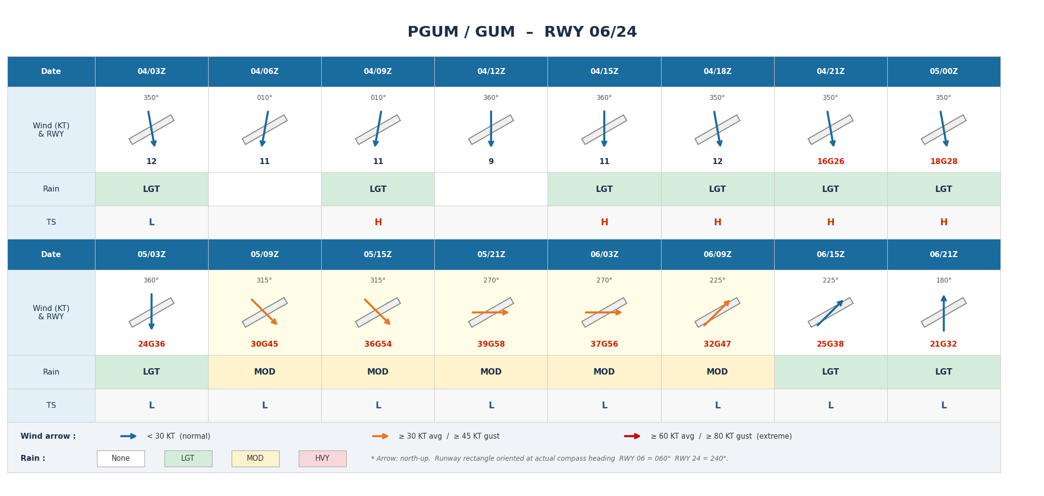
Impact on Guam International Airport (PGUM / GUM)
At Guam International Airport (PGUM), peak wind conditions are expected from around July 5 09Z as the typhoon approaches.
Wind and rain are expected to gradually intensify, with peak precipitation and wind forecast between July 5 09Z and July 6 09Z. Strong westerly winds with sustained speeds of 35–40 kt and maximum gusts of 50–60 kt are anticipated. From July 6 09Z onward, winds are expected to shift from southwest to south while gradually decreasing in speed, reaching approximately 20–25 kt sustained with 30–40 kt gusts by around 15Z. Intermittent light rain (LGT) may continue, though operational impacts are expected to gradually diminish.
Looking Ahead
Typhoon track, intensity, and wind speed forecasts at the time of closest approach may change. Please continue to monitor the latest typhoon information, airport forecasts, and operational updates.
For more timely and detailed information on typhoons and tropical disturbances, please visit SkyAviators, the aviation decision-support tool for airline operators. Learn more about "SkyAviators"
Disclaimer
This article is provided for reference purposes only. Specific operational support for individual flights is available exclusively through our paid services for aviation operators. Weathernews Inc. assumes no responsibility for operational decisions made with reference to this article, or for any losses or damages arising therefrom.