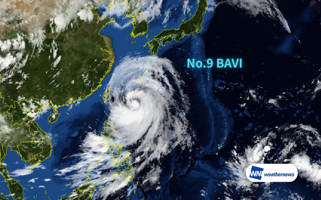
Current Typhoon Status
According to information released by the Japan Meteorological Agency (JMA) at 17:40 JST on July 10, 2026, Typhoon No. 9 (BAVI), a large and very intense typhoon, was located approximately 330 km south-southeast of Miyakojima (22.1°N, 126.7°E) as of 17:00 JST on July 10, moving north-northwest at 11 kt. Central pressure is 935 hPa, with maximum sustained winds of 85 kt and maximum gusts of 120 kt near the center.
Track Outlook
The typhoon is expected to pass near the Sakishima Islands as a very intense typhoon around the early hours of July 11, and after passing north of Taiwan in the afternoon, is forecast to make landfall along the coast between Xiapu, Fujian Province, and Wenling, Zhejiang Province in the evening. After landfall, it is expected to track northwest while gradually weakening.
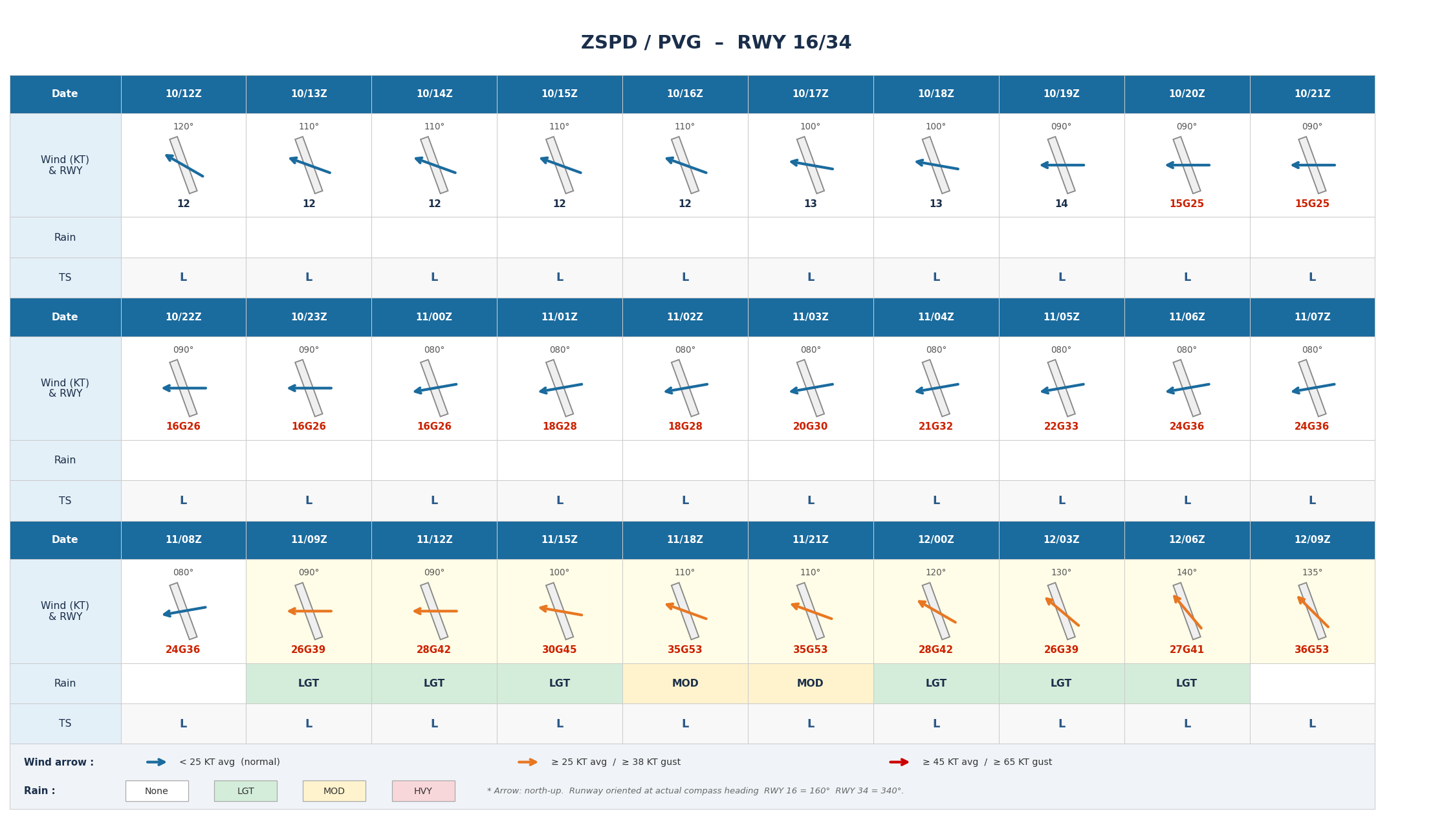
Shanghai Pudong International Airport, China (ZSPD/PVG)
At Shanghai Pudong International Airport, winds of 20 kt or more are expected to persist from 03Z on July 11 through July 13 (all times UTC). The strongest winds are forecast during 15Z July 11 – 00Z July 12 and 09Z – 21Z July 12, with mean wind speeds expected to exceed 30 kt. Moderate precipitation is also expected between 19Z and 23Z on July 11.
From July 14 onward, winds are expected to drop below 20 kt, though continued attention to forecast updates is advised.
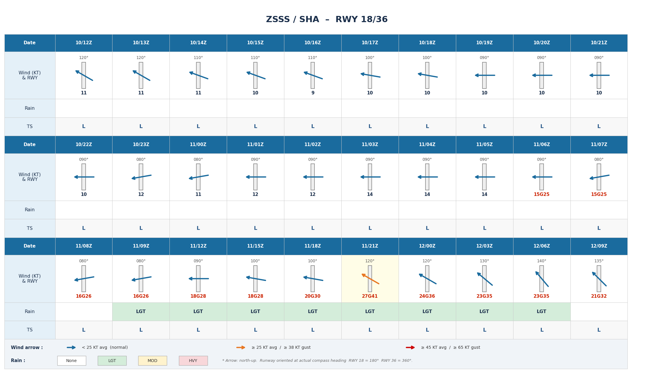
Shanghai Hongqiao International Airport, China (ZSSS/SHA)
At Shanghai Hongqiao International Airport, wind directions are expected to range between 80° and 130°, with crosswind components exceeding 15 kt from 06Z July 11 through 03Z July 12. The strongest winds are forecast between 21Z July 11 and 08Z July 12, with mean wind speeds of 21–27 kt and maximum gusts of 32–41 kt.
From 18Z July 12, winds are expected to drop below 20 kt and gradually diminish.
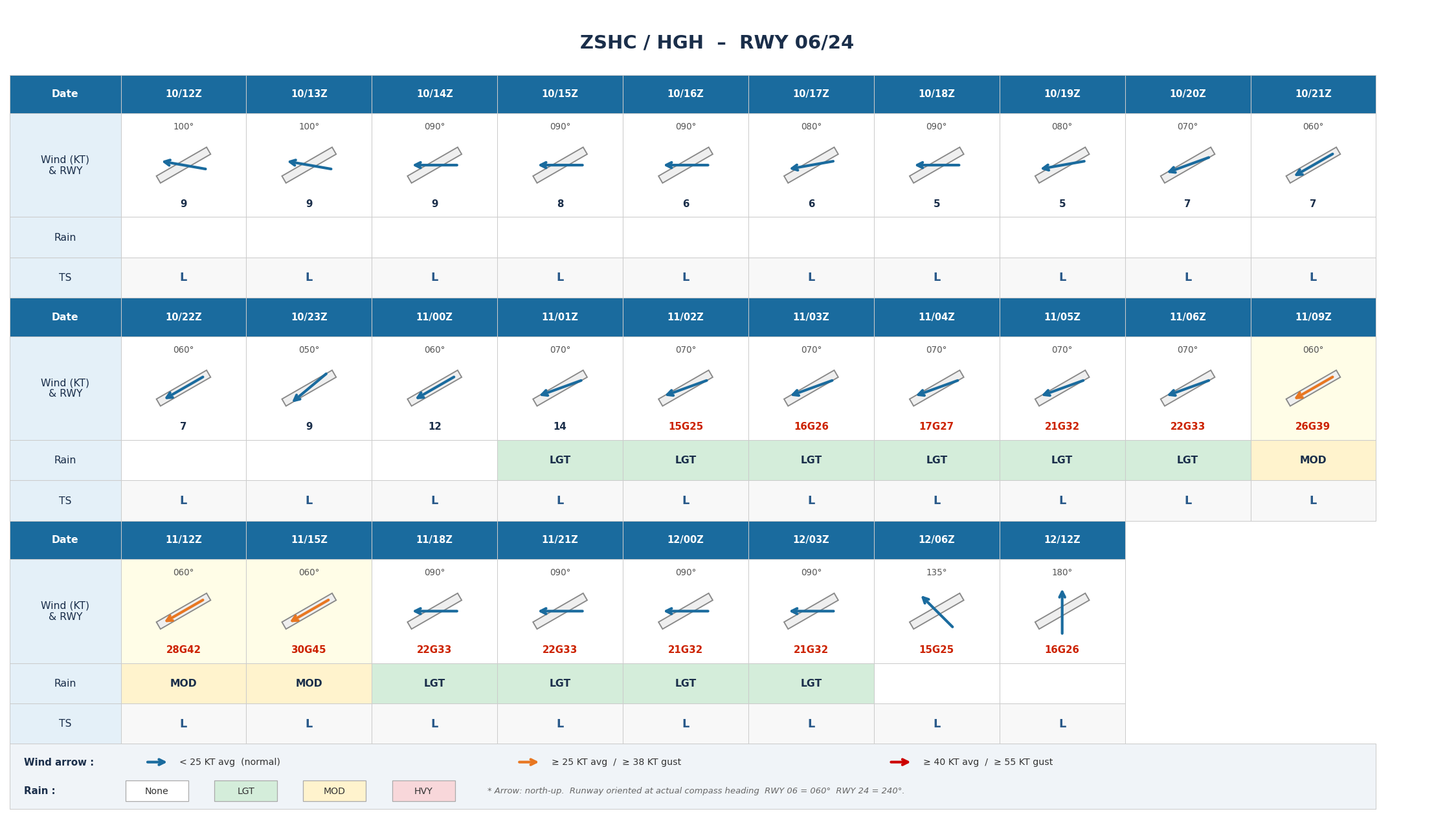
Hangzhou Xiaoshan International Airport, China (ZSHC/HGH)
At Hangzhou Xiaoshan International Airport, wind speeds are generally expected to reach 20 kt or more from 04Z July 11 through 05Z July 12. The peak wind period is forecast around 10Z–19Z July 11, with mean wind speeds of 26–30 kt and maximum gusts reaching 39–45 kt.
From 06Z July 12, wind speeds are expected to drop to 20 kt or below, and precipitation is forecast to gradually subside overall.
Typhoon track, intensity, and wind speed forecasts at the time of closest approach may change. Please continue to monitor the latest typhoon information, airport forecasts, and operational updates.
For more timely and detailed information on typhoons and tropical disturbances, please visit SkyAviators, the aviation decision-support tool for airline operators. Learn more about "SkyAviators"
Disclaimer
This article is provided for reference purposes only. Specific operational support information for individual flights is available exclusively through our paid services for aviation operators. Weathernews Inc. assumes no responsibility for any operational decisions made with reference to this article, or for any losses or damages arising therefrom.