Current Status
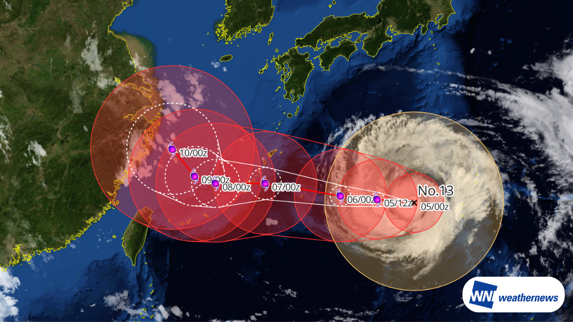
According to information issued by the Japan Meteorological Agency (JMA) at 09:50 JST on August 5, 2026, Typhoon No. 13 DOLPHIN — a large and very strong typhoon — was located south of Japan (25.5°N, 138.3°E) at 09:00 JST on August 5, moving westward at 9 kt. Central pressure is 945 hPa, maximum sustained winds near the center are 85 kt, and maximum gusts reach 120 kt.
Track Outlook
Typhoon No. 13 DOLPHIN is expected to continue tracking westward, passing near Okinawa's main island around the afternoon to evening of August 7. After that, it is forecast to slow down and move into the East China Sea. Due to its wide storm-force wind radius, Okinawa may experience prolonged rough conditions.
Regarding potential impacts on China, parts of East China may see strong winds and heavy rain from around August 9. There is also a possibility of the storm moving northward along the East China coast between August 10 and 12, bringing substantial rainfall to northern East China and North China.
Forecast for Naha Airport (ROAH/OKA)
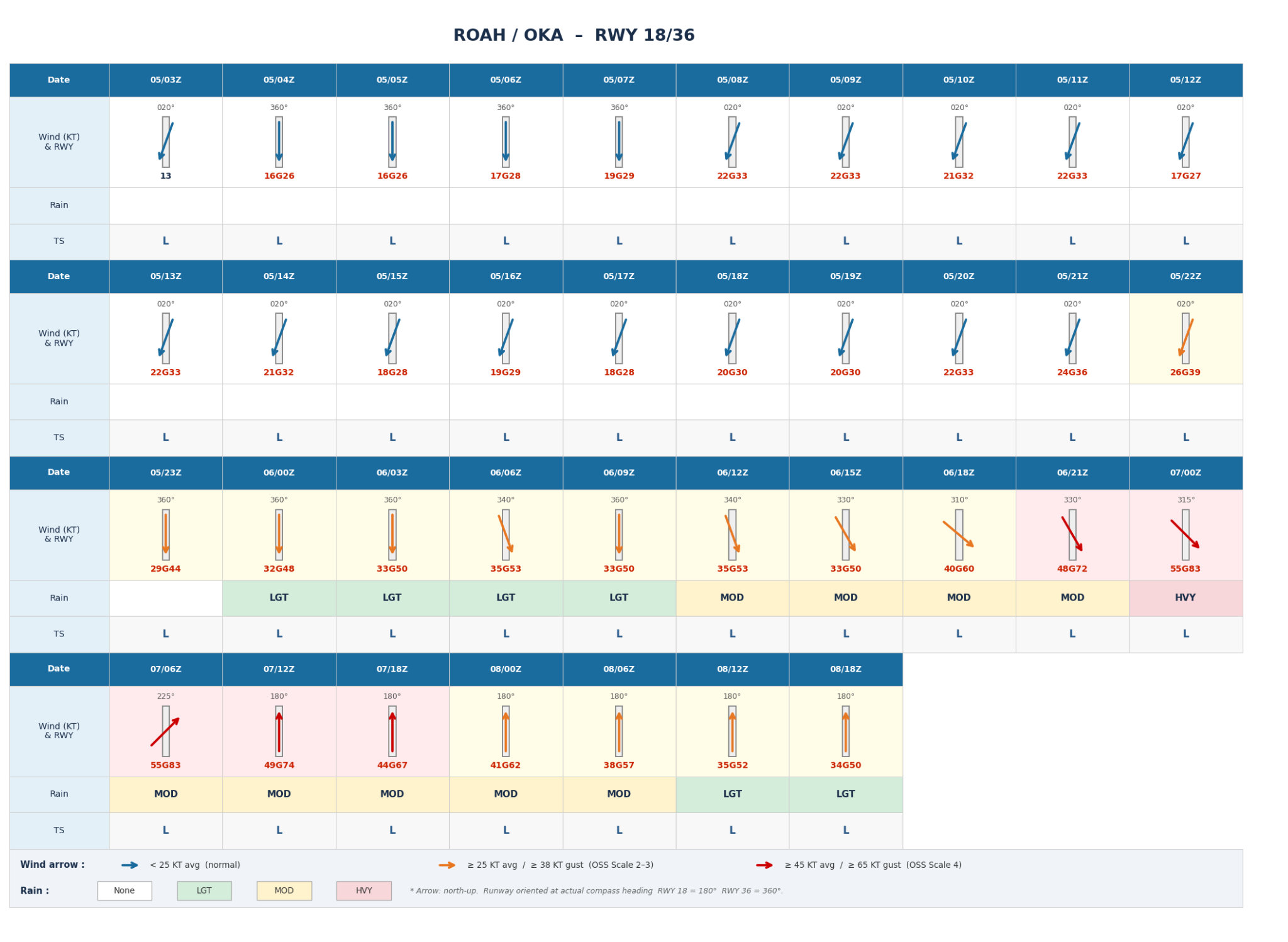
As Typhoon No. 13 DOLPHIN approaches, crosswinds at Naha Airport (ROAH/OKA) are expected to gradually intensify from August 6, with impacts peaking around August 7. In particular, from 00:00 to 12:00 UTC on August 7, winds are forecast to blow from the northwest to southwest, with average wind speeds reaching 55 kt and gusts up to 83 kt. The significant crosswind component may cause serious disruptions to RWY 18/36 operations. Periods of heavy rain combined with strong winds are also expected, raising concerns about expanded flight cancellations and delays.
Notice
Significant uncertainty remains regarding the typhoon's further development and detailed track. As the situation may change, please continue to monitor the latest weather forecasts.
For more timely and detailed information on typhoons and tropical disturbances, please refer to "SkyAviators," the decision-support tool for aviation operators. We encourage you to use it to stay updated on the latest developments. Learn more about "SkyAviators" here.
Disclaimer
This article is provided for reference purposes only. Specific operational support information for individual flights is available exclusively through our paid services for aviation operators. Weathernews Inc. assumes no responsibility for any operational decisions made based on this article, nor for any losses or damages arising therefrom.
![[Tropical Depression] Forecasted to Become Typhoon DUJUAN – Expected to Approach Japan as a "Strong" System](https://gvs.weathernews.jp/wxtech_cms/typhoon25_dujuan_cover_de9913c666.png)