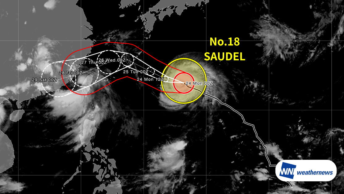
Current Situation
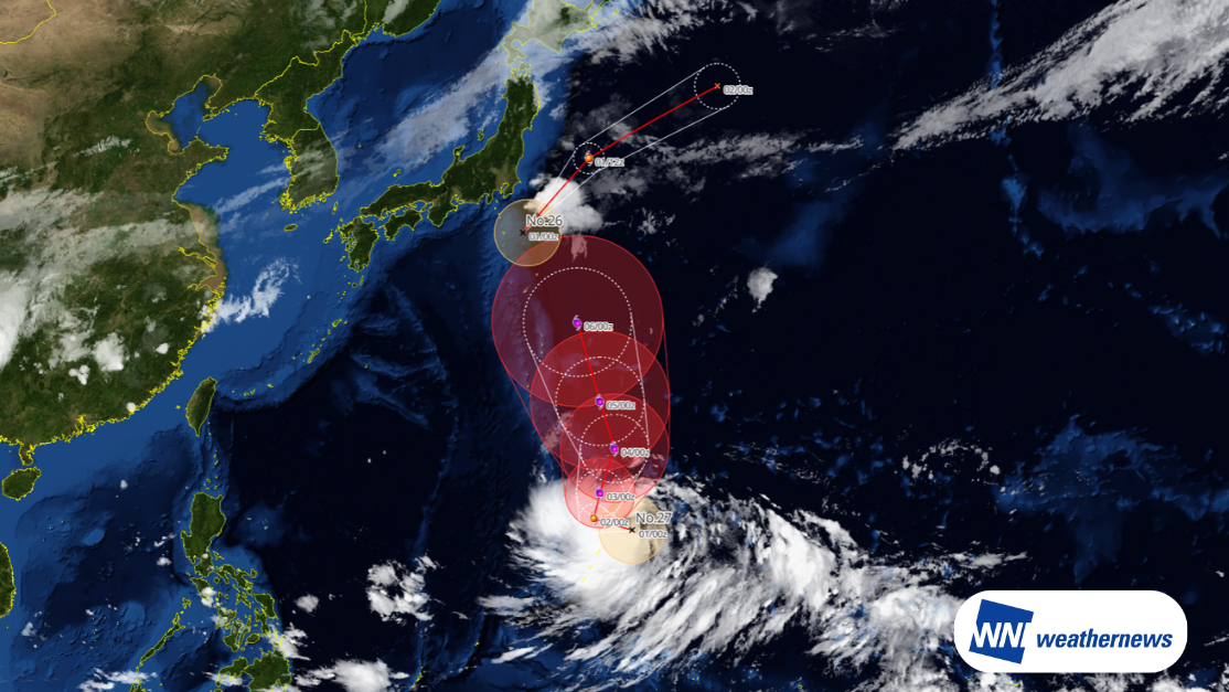
According to a bulletin issued by the Japan Meteorological Agency (JMA) at 09:50 JST on August 24, 2026, very strong Typhoon Saudel (Typhoon No. 18) was located south of Japan (24.0N, 136.4E) as of 09:00 JST on August 24, moving west-northwest at 18 kt. Its central pressure was 940 hPa, with maximum sustained winds near the center of 90 kt and maximum gusts of 130 kt.
Forecast Track
The typhoon is expected to continue intensifying as it moves generally westward, passing near the main island of Okinawa at strong intensity from the night of August 25 through the morning of August 26 local time. Heavy rain, storm-force winds, and high waves are a concern for the main island of Okinawa and Amami Oshima.
Afterward, the typhoon is expected to gradually curve southwestward, passing through waters north of Taiwan before potentially making landfall somewhere between China's Zhejiang and Guangdong provinces. Strong winds and heavy rain are possible across central to northern Taiwan and along the southeastern coast of China.
At this stage, forecast models still show significant divergence in the expected track, so the impact on each region could change considerably depending on how the typhoon's path develops. Please continue to monitor the latest typhoon information.
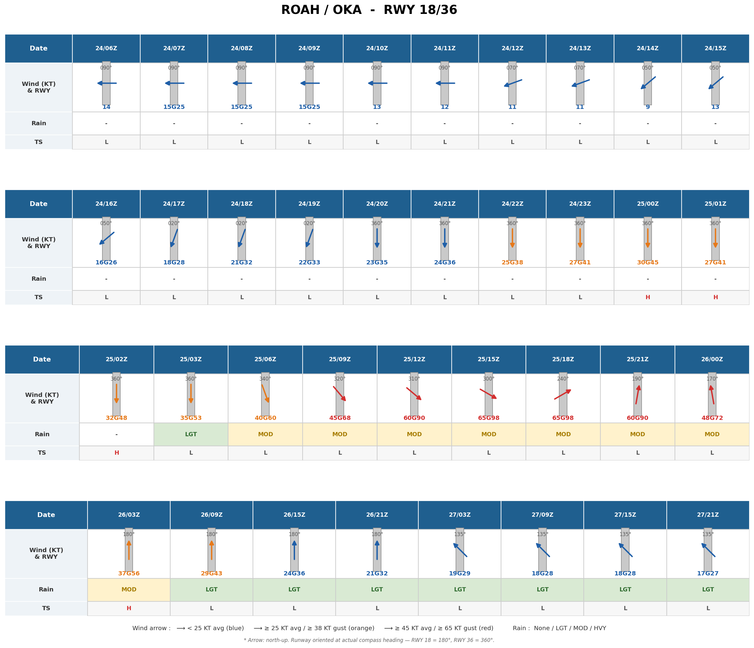
Forecast for Naha Airport (ROAH/OKA)
Average wind speed is expected to exceed 20 kt from around 18Z on August 24 (UTC is used throughout this forecast), 30 kt from around 01Z on August 25, and 40 kt from around 06Z on August 25. Winds will be strongest between roughly 12Z on August 25 and 00Z on August 26, with average speeds of around 50-60 kt and gusts of around 70-90 kt. Winds will then gradually ease as the typhoon moves away, dropping below 20 kt by the afternoon of August 27 local time.
Notes
Typhoon track, intensity, and wind speed forecasts at the time of closest approach may change. Please continue to monitor the latest typhoon information, airport forecasts, and operational updates.
For more timely and detailed information on typhoons and tropical disturbances, please visit SkyAviators, the aviation decision-support tool for airline operators. Learn more about "SkyAviators"
Disclaimer: This article is provided for reference purposes only. Specific operational support information for individual flights is provided exclusively through Weathernews' paid services for aviation operators. Weathernews Inc. accepts no responsibility for any operational decisions made based on this article, or for any losses or damages arising from it.