















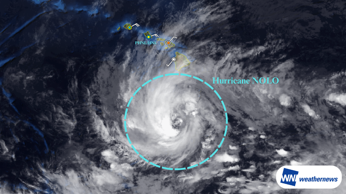
Current Situation
According to information issued by the National Oceanic and Atmospheric Administration (NOAA), as of 03:00 UTC on September 25, 2026, Hurricane NOLO was located approximately 435 km south of South Point on the Island of Hawaii (15.1°N, 155.9°W), tracking north-northeast at approximately 7 km/h (4 kt). The minimum central pressure is 984 hPa, with maximum sustained winds near the center of approximately 65 kt.
Outlook
NOLO is expected to make a significant turn toward the west between September 26 and September 27. Following this track adjustment, the hurricane is forecast to make its closest approach to Oahu and the Honolulu area between September 26 and September 27, bringing peak hurricane-force winds and rough seas.
The storm will continue moving over warm waters, intensifying into a major hurricane with maximum sustained winds exceeding 97 kt between September 28 and September 29. By September 30, it is projected to track into waters northwest of the Hawaiian Islands and gradually weaken.
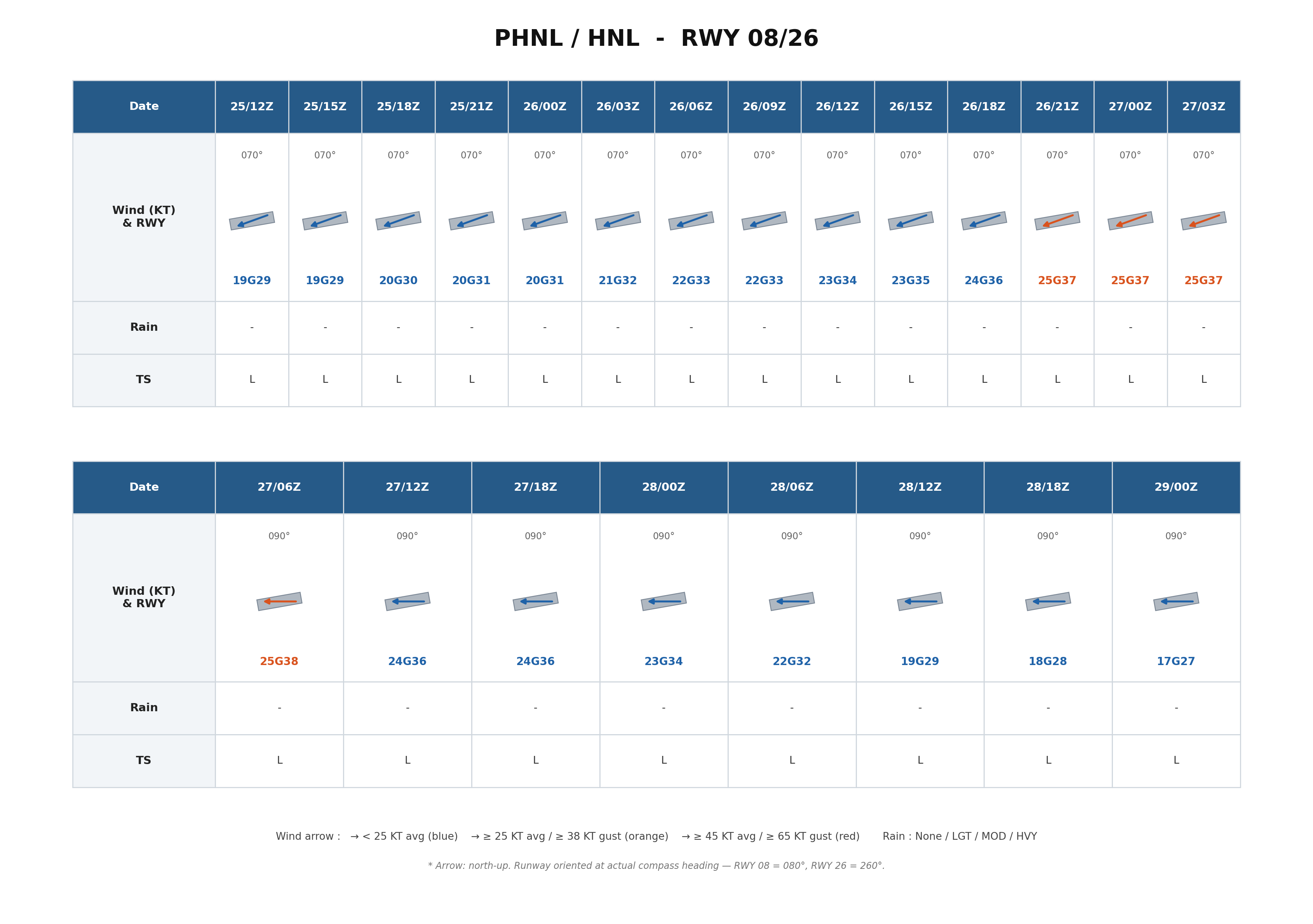
Forecast for Daniel K. Inouye International Airport (PHNL/HNL)
Winds at the airport are currently blowing from the east (070°) at 18 to 19 kt.
- Sustained winds are expected to exceed 20 kt with gusts over 30 kt starting around 16:00 UTC on September 25.
- The strongest winds are anticipated between 21:00 UTC on September 26 and 12:00 UTC on September 27, with average sustained winds of 25 kt and gusts exceeding 35 kt.
- Wind speeds are forecast to decrease below 20 kt after approximately 12:00 UTC on September 28.
Looking Ahead
Typhoon track, intensity, and wind speed forecasts at the time of closest approach may change. Please continue to monitor the latest typhoon information, airport forecasts, and operational updates.
For more timely and detailed information on typhoons and tropical disturbances, please visit SkyAviators, the aviation decision-support tool for airline operators. Learn more about "SkyAviators"
Disclaimer
This article is provided for informational reference only. Flight-specific operational support is available exclusively through our commercial aviation weather services. Weathernews Inc. accepts no liability for operational decisions made based on this article, or for any resulting losses or damages.
![[Tropical Depression] Forecasted to Become Typhoon DUJUAN – Expected to Approach Japan as a "Strong" System](https://gvs.weathernews.jp/wxtech_cms/typhoon25_dujuan_cover_de9913c666.png)
