















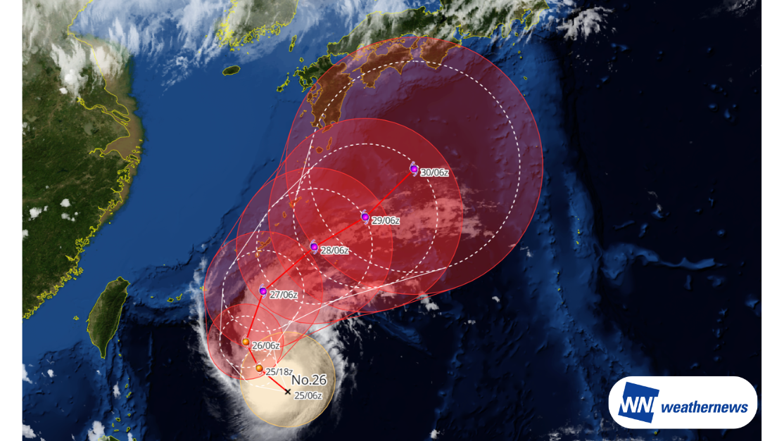
Current Meteorological Situation
According to information released by the Japan Meteorological Agency (JMA) at 15:45 JST on September 25, 2026, Typhoon Surigae (Typhoon No. 26) was located south of Okinawa at 20.5°N, 129.1°E as of 15:00 JST on September 25, moving west-northwest at 10 knots. The central pressure is 1,000 hPa, with maximum sustained winds near the center of 40 knots and peak gusts of 60 knots.
Forecast Track and Outlook
The typhoon is expected to intensify while turning northward, temporarily reaching "Very Strong" typhoon intensity. It is then forecast to curve northeastward and gradually weaken as it tracks south of Okinawa and the Amami region between September 27 and September 28.
Following this, the system is projected to continue tracking south of Honshu while weakening further. Heavy rainfall, gale-force winds, and high waves are highly likely, particularly across Okinawa and the Amami Islands.
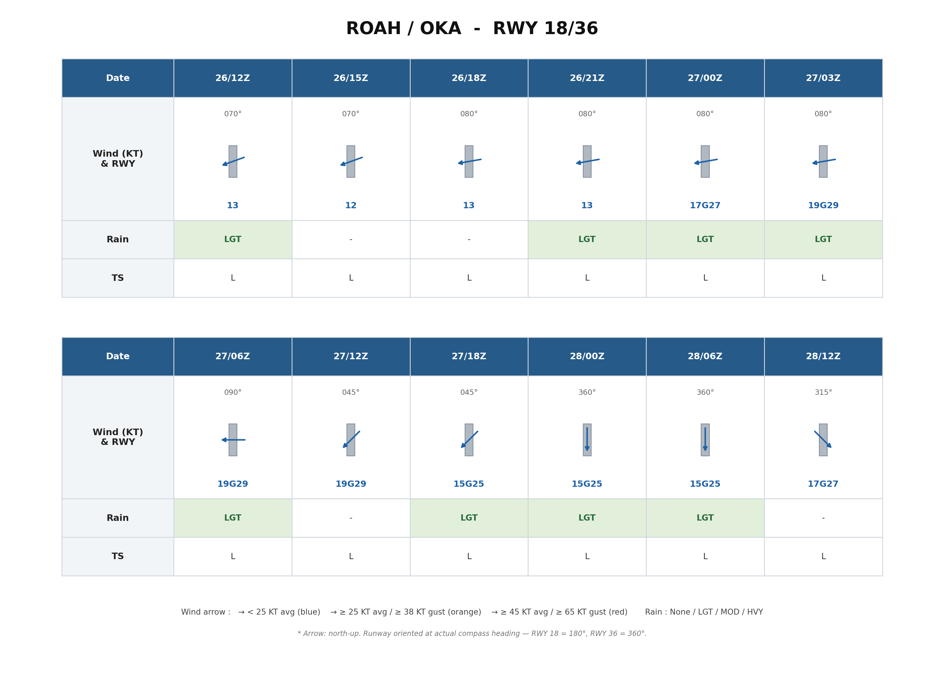
Airport Forecast: Naha Airport (ROAH/OKA)
From September 26 to September 28, mean surface wind speeds at Naha Airport are generally expected to remain below 20 knots. However, with winds prevailing from an easterly direction, substantial crosswind impacts on the runways are anticipated.
In particular, between 00Z and 12Z on September 27, crosswind components are forecast to exceed 15 knots, peaking at up to 19 knots. After 12Z on September 27, as the typhoon tracks northeastward, wind directions will shift and crosswind impacts are expected to gradually diminish.
Looking Ahead
Typhoon track, intensity, and wind speed forecasts at the time of closest approach may change. Please continue to monitor the latest typhoon information, airport forecasts, and operational updates.
For more timely and detailed information on typhoons and tropical disturbances, please visit SkyAviators, the aviation decision-support tool for airline operators. Learn more about "SkyAviators"
Disclaimer
This article is provided for informational and reference purposes only. Specific operational flight dispatch support is provided exclusively through Weathernews' commercial aviation services. Weathernews Inc. accepts no liability whatsoever for any operational decisions made in reliance on this article, or for any losses or damages arising therefrom.
![[Tropical Depression] Forecasted to Become Typhoon DUJUAN – Expected to Approach Japan as a "Strong" System](https://gvs.weathernews.jp/wxtech_cms/typhoon25_dujuan_cover_de9913c666.png)
