Currently, Tropical Depression (07W) is developing over the ocean near Guam, and close attention to its future movements is required. Additionally, there is a general tendency for more typhoons to form this year, increasing the risk of them approaching Japan.
2026 Typhoon Generation Trends (Weathernews Forecast)
According to Weathernews (WNI) forecasts, the number of typhoons generated this year (2026) is expected to reach 27 to 29, exceeding the normal average (about 25).
This is due to the interaction between strong westerly winds from the Indian Ocean and easterly trade winds near the Philippines, creating conditions highly favorable for tropical cyclone formation.
Furthermore, when the El Niño phenomenon peaks around July to September, the location of typhoon generation is expected to shift further east than usual. Depending on the extension of the Pacific High, this increases the risk of more typhoons taking routes that directly approach or make landfall in Japan.
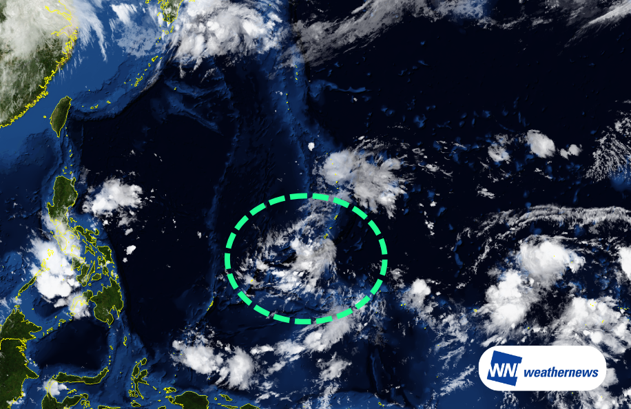
Current Situation
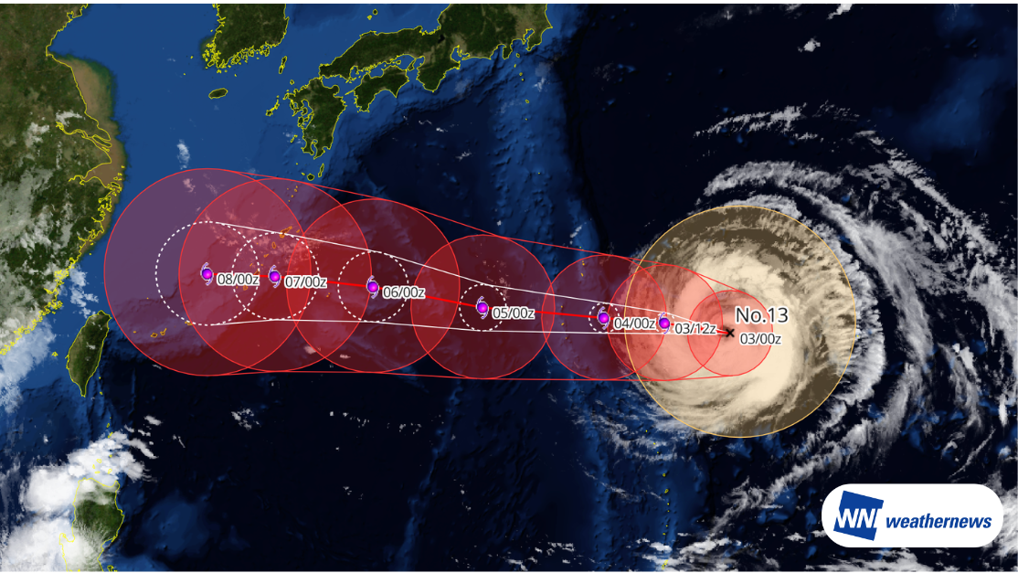
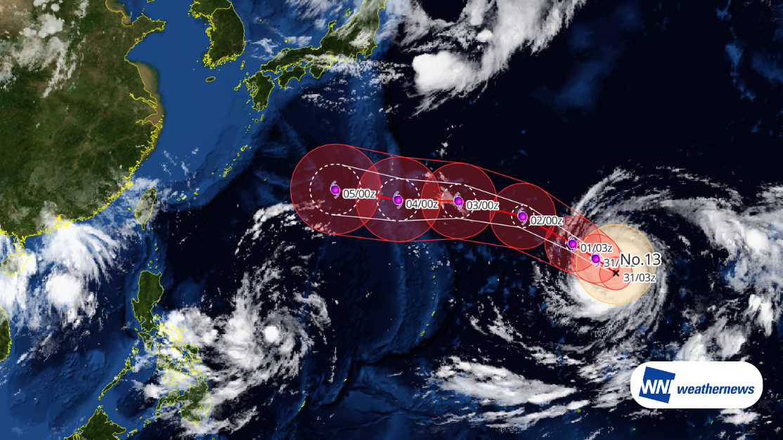
According to the analysis at 03Z on the 19th (UTC), the center of the tropical depression is located at 13.0 degrees North latitude and 142.7 degrees East longitude (over the sea southwest of Guam). The central pressure is 1003 hPa, with a maximum wind speed of 30 knots (maximum instantaneous wind speed of 45 knots), and it is moving west-northwest (heading 289 degrees) at a speed of 19 knots.
Projected Path and Impact
This tropical depression is expected to become a typhoon and continue developing while moving northwest. It is forecasted to change its course to a more northerly direction around 03Z on the 23rd (UTC). As it progresses, the influx of moist air may cause heavy rainfall in the northern Philippines and eastern Taiwan, requiring caution in these areas.
Afterward, although there is uncertainty in the forecast, it is expected to gradually shift its course eastward, moving northeast along the edge of the Pacific High. There is a possibility that it will pass near Okinawa around the 25th to 26th and proceed toward the Kyushu and Shikoku regions. The overall track is expected to resemble that of the previously formed Typhoon No. 6.
Check the Latest Information
The system is currently still in the tropical depression stage, and there is significant uncertainty regarding its future development and changes in its path. Please be sure to check the latest weather information frequently.
- For more timely and detailed information on typhoons and tropical disturbances, please visit "SkyAviators", a decision-making support tool for aviation operators. Click here for more details on "SkyAviators"