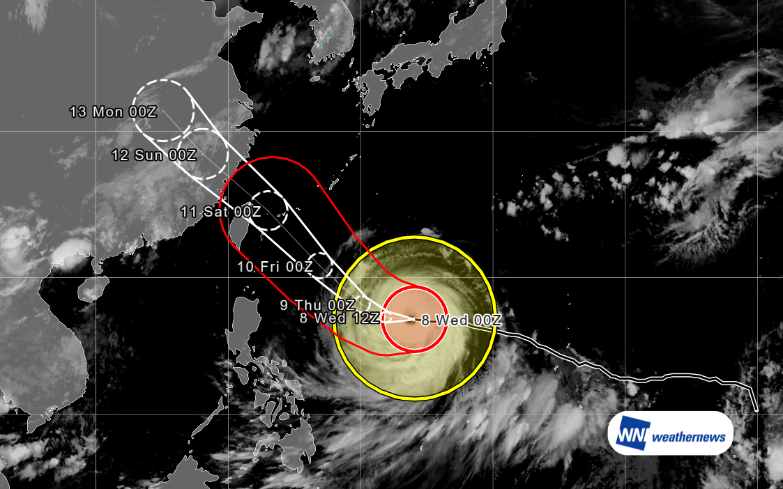
Typhoon Status
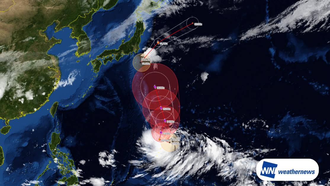
According to information released by the Japan Meteorological Agency (JMA) at 09:45 JST on July 8, 2026, Typhoon No. 9 (Bavi), a large and very intense tropical cyclone, was located east of the Philippines (17.0°N, 134.1°E) as of 09:00 JST on July 8, moving westward at 12 kt. Central pressure is 925 hPa, with maximum sustained winds near the center of 100 kt and maximum gusts of 140 kt.
Forecast Track
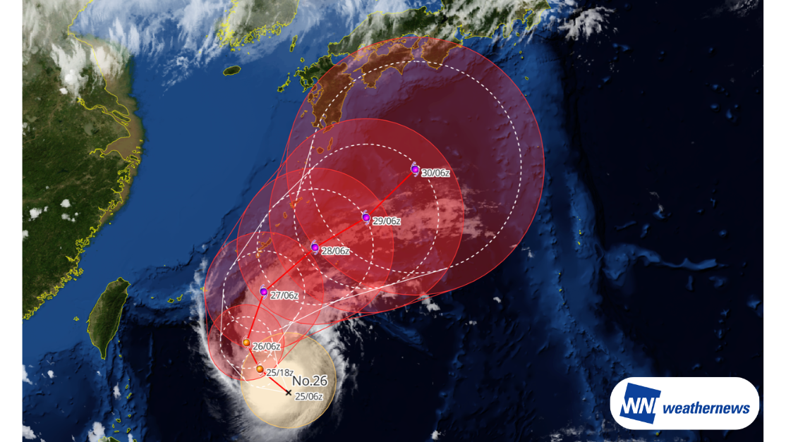
The typhoon is expected to shift course toward the northwest from July 9 onward, passing near the Sakishima Islands in the early hours of July 11 as a very intense typhoon. Significant impacts — including heavy rain, violent winds, high waves, and storm surges — are of concern, particularly for the Sakishima Islands.
At the current forecast stage, direct impacts on the Okinawa main island are expected to remain relatively limited; however, precipitation is forecast due to moist air surrounding the typhoon. Additionally, crosswind impacts should be monitored at Naha Airport (ROAH/OKA).
During the daytime on July 11, the typhoon is expected to approach the northern Taiwan area, bringing widespread rainfall across the island. According to the Central Weather Administration of Taiwan, the probability of typhoon-force winds (≥17.2 m/s, Beaufort scale 7) within the next 120 hours is 98% for Taipei City, Keelung City, and Yilan County. This "typhoon-force wind intrusion probability" represents the likelihood that wind speeds exceeding 17.2 m/s (Beaufort scale 7) will occur at a given location within the forecast period, based on forecast performance from similar typhoon tracks over the past five years. For example, a probability of 80% means that in approximately 80 out of 100 analogous cases, typhoon-force winds were observed. Operational disruptions from storm winds and heavy rain should be closely monitored at Taiwan Taoyuan International Airport (RCTP/TPE) and Taipei Songshan Airport (RCSS/TSA).
The typhoon is subsequently expected to track toward the southeastern Chinese coast and make landfall.
Forecast for Naha Airport (ROAH/OKA)
At Naha Airport (ROAH/OKA), easterly winds (70–110 degrees) are expected to prevail from approximately 09:00 UTC on July 8 through approximately 15:00 UTC on July 10 (all times in UTC hereafter). As the crosswind component on Runway 18/36 will become significant, operational impacts require close attention.
Wind speeds are forecast to generally exceed 20 kt from around 21:00 UTC on July 9, with average wind speeds reaching 30–33 kt and peak gusts of 45–50 kt expected from approximately 03:00 UTC to 21:00 UTC on July 10.
From approximately 21:00 UTC on July 9 through 03:00 UTC on July 11, the runway crosswind component is expected to remain above 20 kt, with light precipitation also forecast.

More timely and detailed information on typhoons and tropical disturbances is available on SkyAviators, the decision-support tool for aviation operators. We encourage you to utilize it for ongoing situation monitoring. Learn more about "SkyAviators"
Disclaimer
This article is provided for reference purposes only. Specific operational support information for individual flights is available exclusively through our paid services for aviation operators. Weathernews Inc. bears no responsibility for any operational decisions made with reference to this article, nor for any losses or damages arising therefrom.