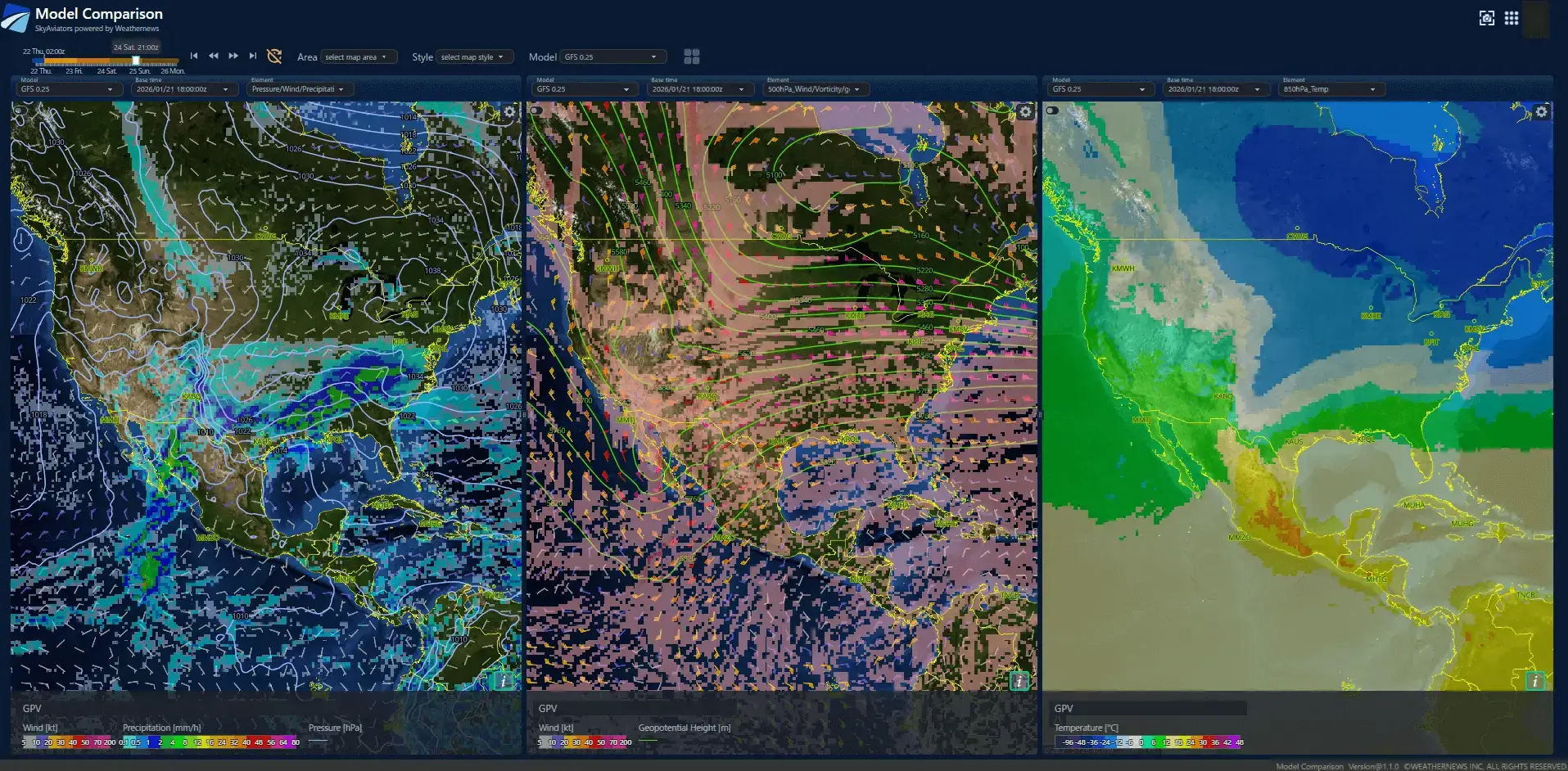
A large-scale winter storm is forecast to affect the US from January 23 through January 26. Heavy snowfall and widespread icing are expected to extend from the central regions to the East Coast, likely making travel difficult across a wide area. At Washington Dulles International Airport, snowfall is forecast to reach 40–50 cm by 26/24Z, accompanied by prolonged periods of low visibility. As a result, extensive operational restrictions and cascading delays are highly likely.
Zooming In on the Weekend: Weekend Weather Outlook for the US (January 24–25)
From January 24 to 25, adverse weather conditions are expected across large parts of the central and eastern US due to the influence of an upper-level trough, cold air aloft, frontal systems, and surface low-pressure development.Periods of intensifying snowfall may result in reduced visibility and low ceilings (VIS/CIG), while snow accumulation and freezing precipitation (PL/FZRA) pose a high risk of icing, requiring heightened vigilance.
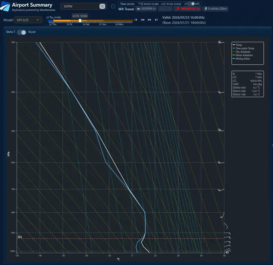
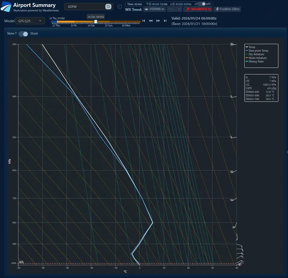
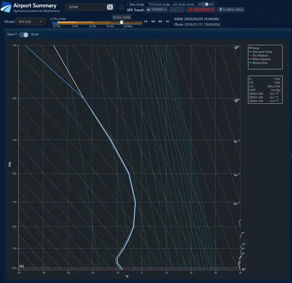
In Atlanta, Dallas, and Houston, precipitation is expected to begin as rain. However, as low-level cold air strengthens and surface temperatures fall, rain is forecast to gradually transition to freezing precipitation (PL/FZRA). In Dallas, weakening mid-level warm air is expected to eliminate the melting layer, allowing precipitation to further change from PL/FZRA to snow.Washington, D.C., and New York are forecast to experience snow throughout the entire event.
Please note that forecast timing and amounts may change depending on the evolution of frontal systems, surface low development, and upper-level cold air intrusion.
Weekend Weather Outlook for Selected Major Airports in the Central and Eastern US
| Airport | Hartsfield–Jackson Atlanta International Airport | Dallas/Fort Worth International Airport | Washington Dulles International Airport | George Bush Intercontinental Airport | John F. Kennedy International Airport |
|---|---|---|---|---|---|
| City | Atlanta | Dallas–Fort Worth | Washington D.C. | Houston | New York |
| ICAO/IATA | KATL / ATL | KDFW / DFW | KIAD / IAD | KIAH / IAH | KJFK / JFK |
| Snow Timing | NIL | from 12Z to 24Z 25th | from 18Z 24th to 24Z 25th | NIL | from 06Z to 24Z 25th |
| Snow Peak | NIL | from 12Z to 21Z 25th | from 06Z to 15Z 25th | NIL | from 15Z to 21Z 25th |
| Low VIS/CIG due to Snow | NIL | from 12Z to 21Z 25th | from 06Z to 15Z 25th | NIL | from 15Z to 21Z 25th |
| Snowfall Amount (by 24Z 25th) | NIL | 15–20 cm | 30–40 cm | NIL | 20–30 cm |
| PL/FZRA Timing | from 21Z 24th to 24Z 25th | from 06Z 24th to 12Z 25th | NIL | from 09Z 25th to 24Z 25th | NIL |
Airline Operational Challenges — Why Do “Unexpected Cancellations” Happen?
Large-scale flight cancellations during winter are often not the result of unforeseen weather. Instead, they often come down to a critical challenge: how to assess forecast reliability within limited decision-making time.
・Even after reviewing the TAF, confidence in the forecast may remain uncertain. ・Numerical weather prediction models can provide additional support, but it is often unclear which model should be prioritized. ・There is little time to check historical performance or consistency across multiple models. ・In operational aviation meteorology, the ability to instantly compare, evaluate, and interpret multiple sources of information has become more essential than ever.
What airlines truly need is a simple, intuitive indicator that allows them to quickly and confidently answer one key question:How reliable is the forecast for this airport?