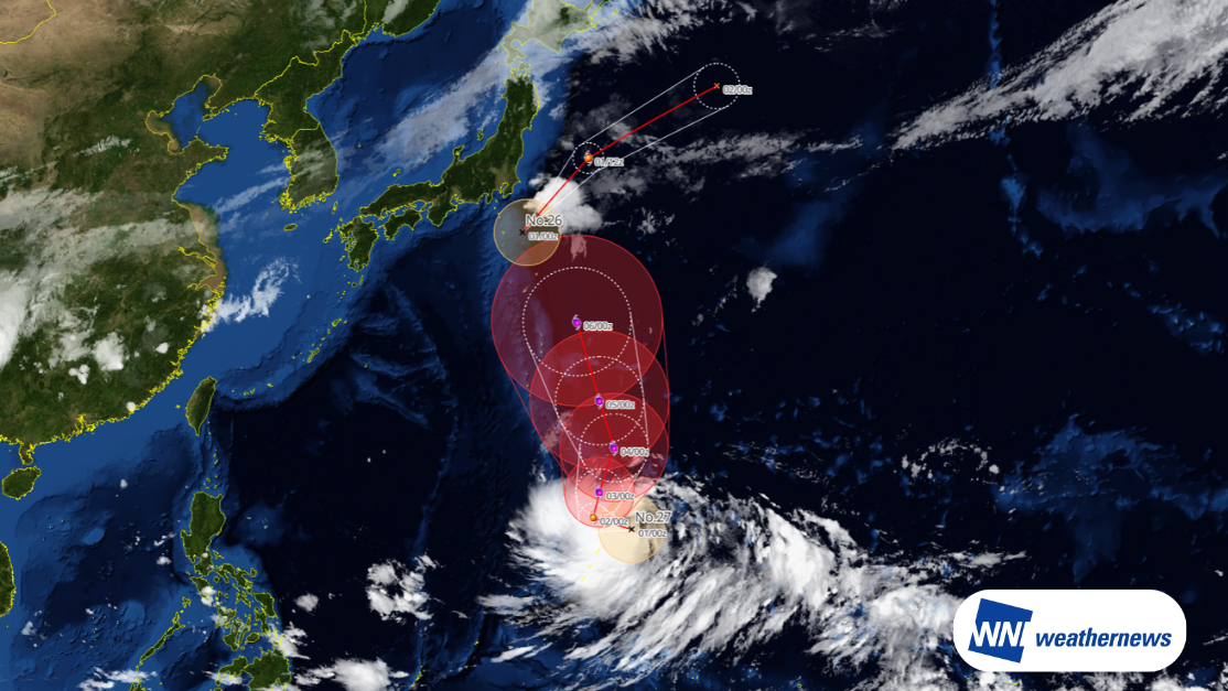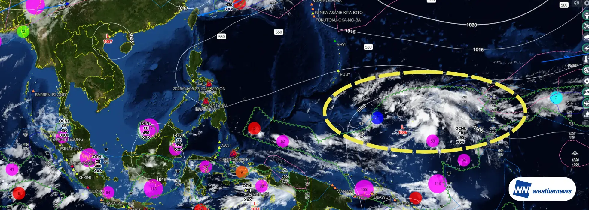
A tropical disturbance near Guam in the western Pacific is showing signs of consolidation, raising the possibility that it may develop into a tropical cyclone.
At present, the active phase of the Madden–Julian Oscillation (MJO) has entered the western Pacific. This pattern is creating an environment favorable for tropical cyclone formation not only in the western Pacific but also across parts of the South Pacific. In addition, the recent evolution of the El Niño–Southern Oscillation (ENSO) is exhibiting characteristics similar to years in which multiple tropical cyclones formed in succession.
*The tropical disturbance outlook presented in this article represents the independent assessment of Weathernews Inc. (WNI).
Meteorological Background & Outlook
Statistical Background (Source: Japan Meteorological Agency, since 1951)
In 2026, one tropical cyclone has formed in each of January, February, and March.
According to statistics from the Japan Meteorological Agency (since 1951): ・Tropical cyclones formed in every month from January through April in only three years: 1955, 1965, and 2015. ・Continuous monthly formation beyond April occurred in only two of those years: 1965 and 2015. ・2015 remains the only year since 1951 in which a tropical cyclone formed in every month of the year (in 1965, the sequence ended in November).
If a tropical cyclone forms in April 2026, it would become the fourth case since 1951 in which tropical cyclones occurred in each month from January through April.
Sources: rological Agency – Tropical Cyclone Statistics
Comparison with ENSO Trends: Similarities with 1965 and 2015
From 2024 to 2025, the climate system transitioned from a pronounced El Niño event toward La Niña conditions (or near-La Niña conditions). Looking ahead, the likelihood of El Niño developing again in the summer of 2026 (around June–August) is increasing.
Among the previously mentioned cases of continuous tropical cyclone formation from January through April, the years 1965 and 2015 showed ENSO transition patterns similar to this sequence (strong El Niño → La Niña or near-La Niña conditions → El Niño). The current situation in 2026 exhibits tendencies comparable to those two years.
For reference, the number of tropical cyclones in those years was as follows (Japan Meteorological Agency statistics): ・Total annual formations: 1965 – 32, 2015 – 27 (climatological average: 25.1) — both years were above the long-term average. ・Total during August–October (three months): 1965 – 15, 2015 – 13 (climatological average: 14.1) — activity during the peak season was close to the climatological average.
While the total number of formations throughout the year was relatively high, activity during the peak season (August–October) tended to remain near the climatological average.
Sources: ENSO Forecast: IRI (International Research Institute for Climate and Society, Columbia University) ENSO Historical Data: NOAA (National Oceanic and Atmospheric Administration)
Outlook
With the active phase of the Madden–Julian Oscillation (MJO) currently positioned over the western Pacific, the disturbance near Guam may develop into a tropical depression and potentially intensify into a tropical cyclone. At present, however, no other signs of new tropical cyclone formation are evident, and this event is expected to remain an isolated occurrence.
This outlook is based on the independent analysis of Weathernews Inc. (WNI). Please continue to monitor the latest weather information for updates on its development and evolving meteorological conditions.