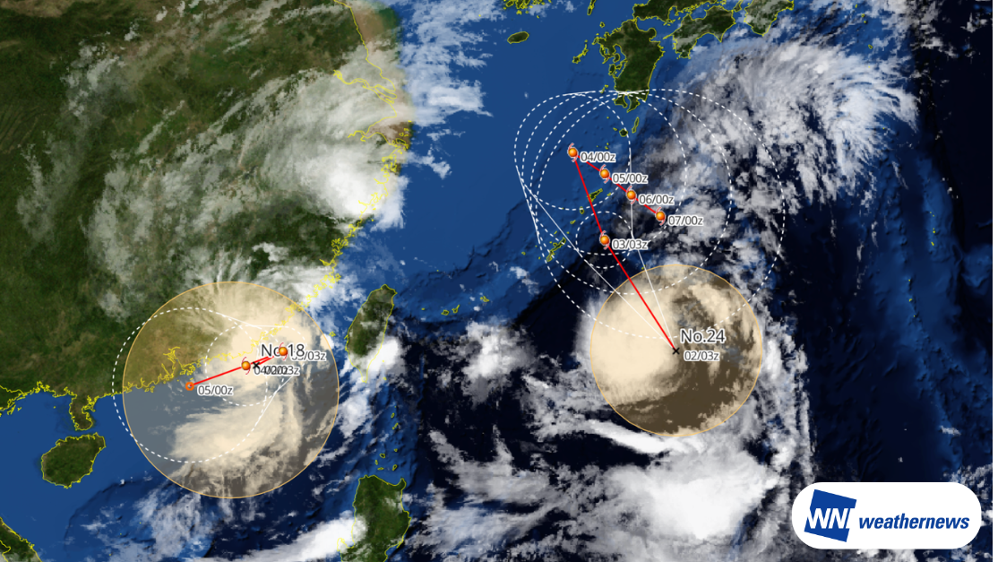
Typhoon SAUDEL is moving northward over the South China Sea. After passing over land, it has re-intensified over the sea, strengthening from a tropical depression back into a typhoon. It is expected to turn westward in the coming days.
Meanwhile, Typhoon KROVANH, located south of Japan, is expected to slow down from September 5 onward, potentially resulting in a more complex and erratic track.
Active Typhoons
Typhoon Saudel
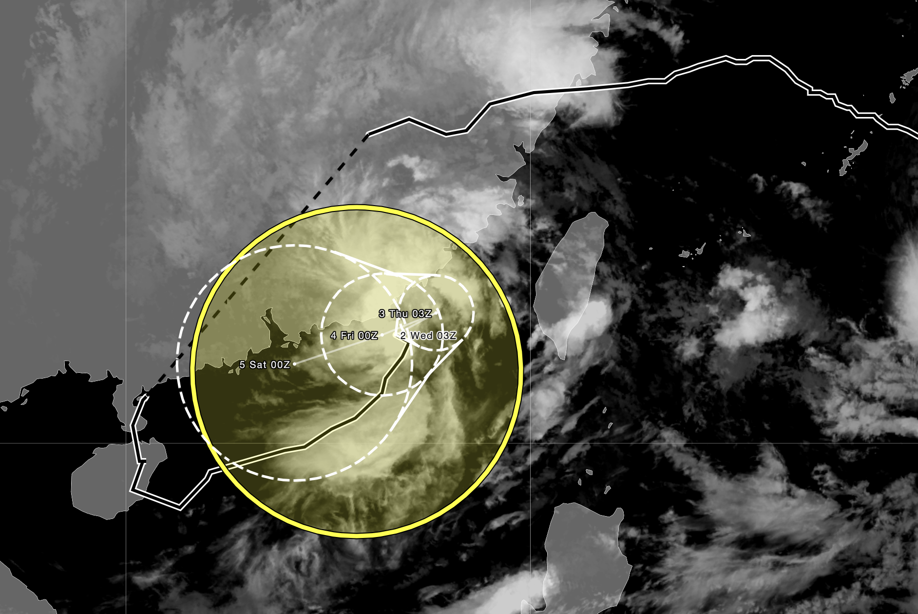
According to information released by the Japan Meteorological Agency (JMA) at 13:05 JST on Wednesday, September 2, 2026, Typhoon No. 18 (Saudel) was located in the South China Sea (22.5°N, 116.7°E) as of 12:00 JST on Wednesday, moving slowly northward. The central pressure was 992 hPa, with maximum sustained winds of 35 kt and maximum gusts of 50 kt.
Saudel is expected to move northeastward while remaining near its current intensity at first. It is then forecast to turn westward and gradually weaken near the coast of southern China around September 4.
Typhoon Krovanh
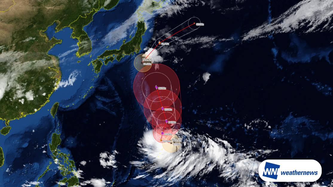
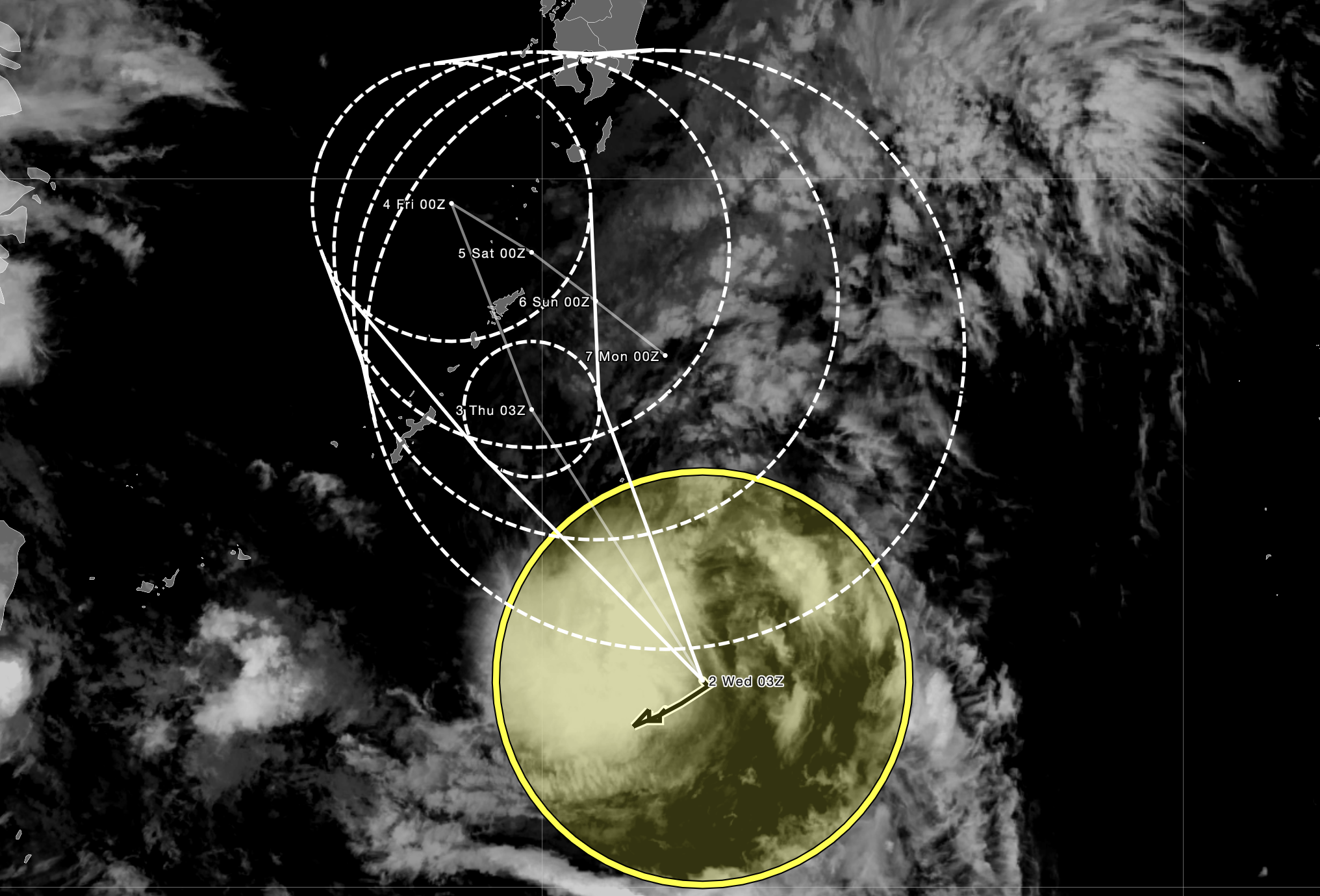
According to information released by the Japan Meteorological Agency (JMA) at 12:45 JST on Wednesday, September 2, 2026, Typhoon No. 24 (Krovanh) was located south of Japan (23.0°N, 132.5°E) as of 12:00 JST on Wednesday, moving slowly northward. The central pressure was 996 hPa, with maximum sustained winds of 35 kt and maximum gusts of 50 kt.
Krovanh is expected to continue moving slowly northward along the western edge of the Pacific High through around September 4. From around September 5, it may become positioned between the Pacific High to the east and a high-pressure system over the Asian continent to the west.
As the steering flow around the system weakens, Krovanh may slow down and become prone to a more variable track. Small changes in the surrounding pressure pattern could have a greater influence on its direction of movement.
Typhoon Saudel: Redevelopment After Weakening Over Land and Potential for a Track Shift
Why Did Saudel Reintensify after Weakening over Land?
Although the remnant vortex weakened significantly over land, it did not completely dissipate. It subsequently moved southward, seemingly pushed by the cold air, and eventually entered the South China Sea.
Sea surface temperatures in the northern South China Sea were widely above 28°C, providing a favorable thermodynamic environment for the development of convective activity and the maintenance of the system’s strength.
At the time, the monsoon trough was active over the South China Sea, while abundant moisture was present along the Intertropical Convergence Zone (ITCZ). After entering the South China Sea, the remnant vortex benefited from the supply of warm, moist air, allowing convective activity to gradually intensify and the system to reorganize and redevelop.
Why Could Saudel Turn Westward?
Although SAUDEL is currently moving northward, it may turn westward as three factors come into play:
- Influence of the monsoon trough
After entering the South China Sea, SAUDEL was steered eastward by the southwest monsoon. As the surrounding winds and pressure pattern changed, its movement gradually slowed. - Interaction with KROVANH and the Pacific High
To the east, Typhoon 24 KROVANH is moving northward, while the surrounding pressure pattern, including the Pacific High, is also changing. - Influence of southward-moving cold air
Cold air moving southward from the north will further alter the winds and pressure pattern around the typhoon. As a result, SAUDEL may reverse its direction and gradually weaken while moving westward.
Historical Example: Typhoon Wayne in 1986
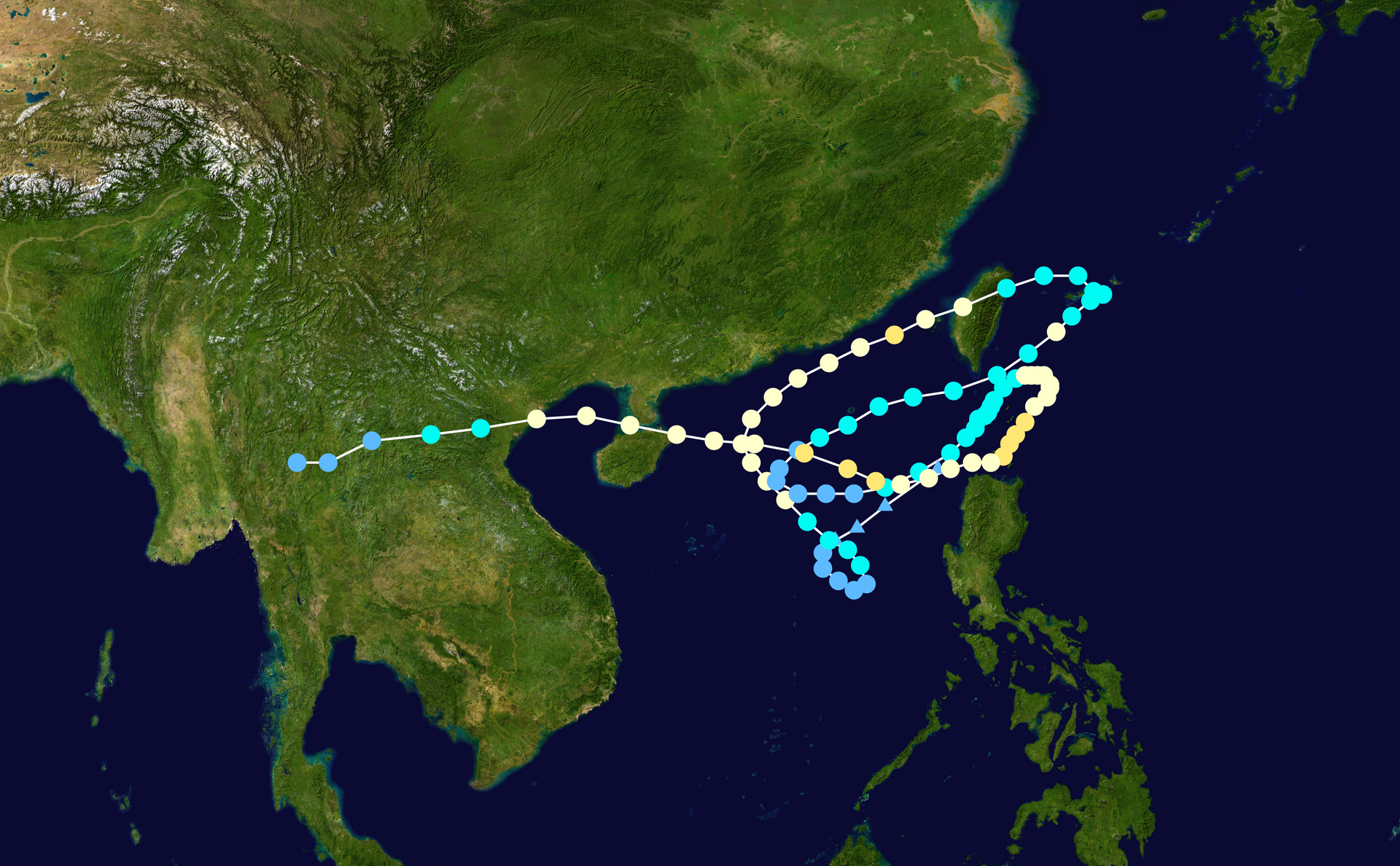
A well-known historical example of a tropical cyclone with a complex track and repeated redevelopment is Typhoon Wayne in 1986.
Wayne formed on August 16 and remained active for around 20 days before dissipating on September 6. It followed an unusually complicated path between the northern South China Sea and the western Philippine Sea, making five major track changes, including four turns of approximately 180 degrees. Its track formed three loops and a figure-eight pattern.
During its lifetime, Wayne weakened to a tropical depression twice before redeveloping into a typhoon. Its unusual track was influenced by changes in the monsoon flow and surrounding high-pressure systems, as well as interaction with Typhoon Vera.
Saudel and Krovanh are currently in an environment where changes in surrounding winds and pressure patterns could affect their movement. Close attention should be paid to the latest forecasts.